Island Park · Maine · United States
Acadia National Park
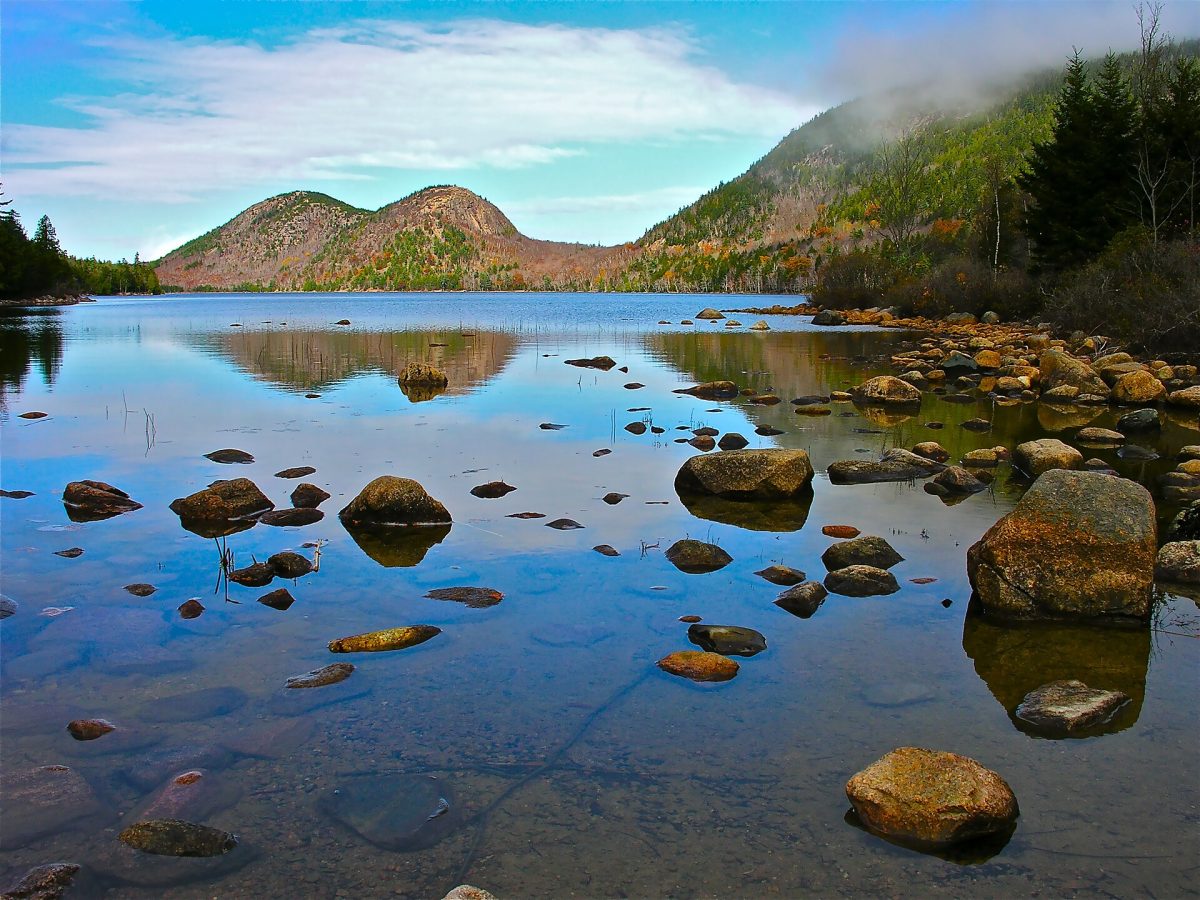
Photo: Plh1234us, CC BY-SA 3.0
- Type
- Island Park
- Where
- Maine, United States
- Area
- 199 km²
- Founded
- 1916
- Visitors
- 4.1 million a year (2025)
- Elevation
- 466 m above sea level
- Tickets
- 14 tickets and tours
- Website
- nps.gov/acad
Acadia National Park tickets and tours: which one to book
Acadia is the granite-and-sea park on Mount Desert Island in Maine, five hours north of Boston, and it is visited from Bar Harbor, the town at its edge, on bus tours, private tours and bicycles. The guided bus tours of two and a half hours drive the Park Loop Road to Sand Beach, Thunder Hole, Otter Cliffs, Jordan Pond and the Cadillac Mountain summit with a narration, which is the easy overview and the option for the cruise-ship passengers who fill Bar Harbor on ship days; the private full-day tours with a guide add the hikes, the carriage roads and the quiet side of the island, and the small-group hiking days climb the Beehive, the Precipice or the Bubbles with a naturalist.
The e-bike and cycling tours ride the 45 miles of carriage roads that Rockefeller built, with their stone bridges, and the kayak trips paddle Frenchman Bay or the ponds. The Cadillac summit sunrise, the first light on the United States for half the year, needs a vehicle reservation booked online from late May to October on top of the park pass, and the sunrise driving tours hold their own. The park entrance fee is per vehicle for seven days or the annual pass, bought online, and the free Island Explorer buses link Bar Harbor, the trailheads and the Loop Road from June to October, which is the way to avoid the parking. The two-day tours from Boston are long drives for a day in the park. Independent visitors drive the Loop Road early, walk the Ocean Path and Jordan Pond, and take the bus to the trailheads.
14 tickets and tours for Acadia National Park
Live dates and prices from GetYourGuide. Free cancellation on most tickets.
Visiting Acadia National Park: what you will see
The park was created in 1916 as a national monument, the first national park east of the Mississippi in 1919 and named Acadia in 1929, and it covers about 199 square kilometres of Mount Desert Island, the Schoodic Peninsula and Isle au Haut on the Maine coast, a landscape of glaciated granite domes rising from the sea, with Cadillac Mountain at 466 metres the highest point on the Atlantic coast of the United States, spruce and fir forest, lakes in the valleys and a shore of pink granite ledges and cobble beaches. The Park Loop Road follows the eastern shore past Sand Beach, the one sand beach in cold water, Thunder Hole, where the swell booms into a cleft, and the Otter Cliffs, and climbs to the Cadillac summit for the view over Frenchman Bay and its islands; Jordan Pond, a glacial lake with the two rounded Bubbles at its head and the lawn of the Jordan Pond House with its popovers, is the park's genteel centre, and the carriage roads, 45 miles of gravel built by John D. Rockefeller Jr.
between 1913 and 1940 with seventeen stone bridges, loop through the forest for walkers, cyclists and horses with no cars allowed. The trails are granite too: the Beehive and the Precipice with their iron rungs and ladders up the cliffs, the Bubbles, the Gorham Mountain ridge and the Ocean Path along the shore, and the Jordan Pond loop on the water's edge. The western side of the island, with Echo Lake, the Bass Harbor Head lighthouse on its rocks and the fishing village of Southwest Harbor, is the quiet half; the Schoodic Peninsula across the bay has the surf on its granite point and a tenth of the visitors. The forest holds moose rarely, white-tailed deer, beavers in the ponds, the peregrines that nest on the Precipice and close its trail in spring, and the bald eagles and harbour seals of the bay. The Wabanaki people summered here for 10,000 years, the rusticators and the millionaires of the Gilded Age built Bar Harbor's cottages, and the 1947 fire that burned a third of the island made the deciduous woods of today. The park receives four million visitors a year, most in three months.
Acadia National Park: best time to go, seasons and hours
The park is open all year; the Park Loop Road is closed by snow from December to mid-April except for a short section, and the Island Explorer buses run from late June to mid-October. July and August are warm and full, with the Cadillac reservations and the Jordan Pond parking gone by nine; September to mid-October is the best time, with the foliage from the last week of September, clear air and space;
spring is muddy with the trails closed for the peregrines; winter brings snow, cross-country skiing on the carriage roads and empty views. Allow two days for the Loop Road, the carriage roads and a hike, three with the west side and Schoodic. Bar Harbor is the town, Bangor the nearest airport, and Boston five hours south.
More tours and activities in Maine
Before you go
Can I book a tour or safari in Acadia National Park online?
Yes. GetYourGuide lists 14 tickets and tours for Acadia National Park, with live dates and prices and free cancellation on most of them.
How much is the entrance fee for Acadia National Park?
The park entrance fee is per vehicle for seven days or the annual pass, bought online, and the free Island Explorer buses link Bar Harbor, the trailheads and the Loop Road from June to October, which is the way to avoid the parking.
When is Acadia National Park open?
The park is open all year; the Park Loop Road is closed by snow from December to mid-April except for a short section, and the Island Explorer buses run from late June to mid-October.
How many days do you need in Acadia National Park?
Allow two days for the Loop Road, the carriage roads and a hike, three with the west side and Schoodic.
How big is Acadia National Park?
Acadia National Park covers 199 km².
When was Acadia National Park founded?
Acadia National Park was established in 1916.
How many people visit Acadia National Park?
Acadia National Park receives about 4.1 million a year (2025).
Where is Acadia National Park?
Acadia National Park is in Maine, United States. The map on this page shows the exact spot.