W National Park
Benin
The W National Park lies at the meeting point of three countries of West Africa, Niger, Benin and Burkina Faso, and…
No online ticket
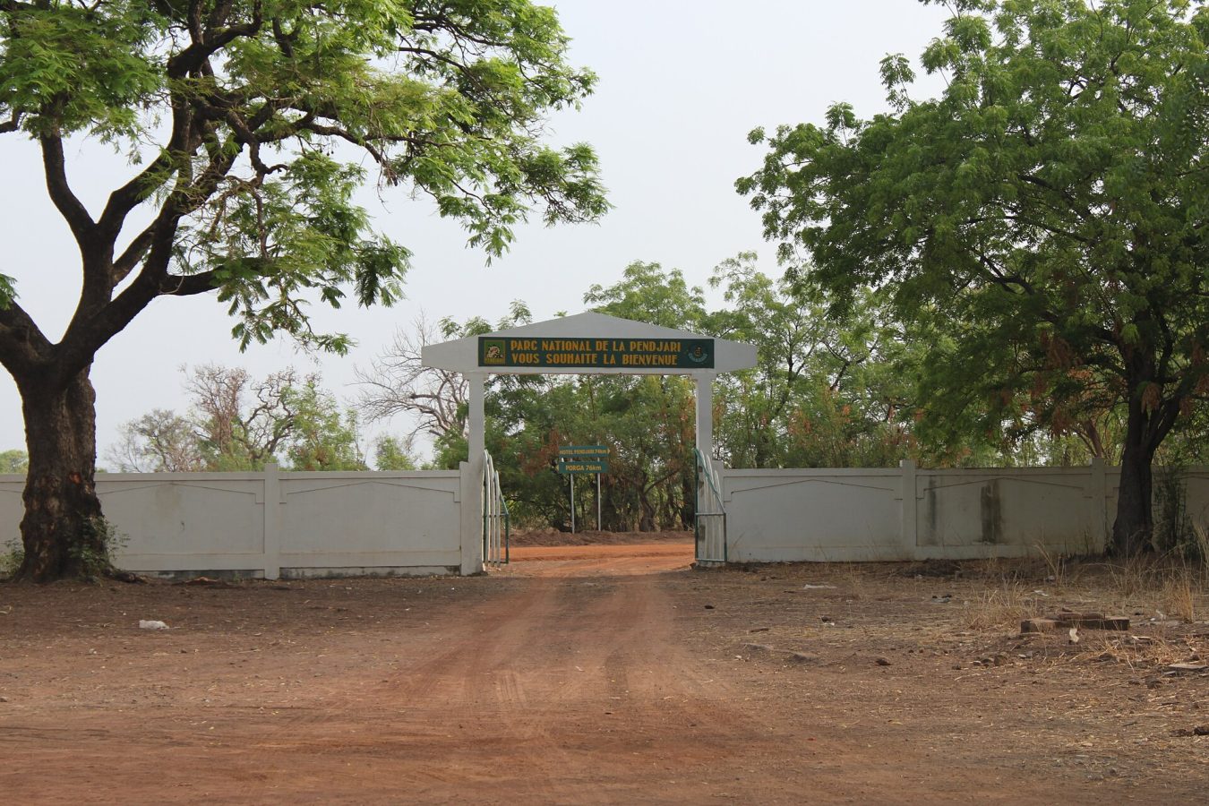
Photo: Fawaz.tairou, CC BY-SA 3.0
Pendjari lies in the far north-west of Benin, against the border of Burkina Faso, and for some years it was reckoned the best place in West Africa to see big game, the one park in the region where lions, elephants, buffalo and a wide variety of antelope could be found with a reliability approaching that of East Africa. It is essential to say at the outset that the situation has changed. Since 2019, when two French visitors were kidnapped in the park and their Beninese guide murdered, armed jihadist groups operating from Burkina Faso and Niger have carried out repeated attacks in the border zone, in which rangers, soldiers and civilians have been killed, tourism has collapsed, and foreign governments advise against all travel to the park and the surrounding region; anyone reading this must consult the current official advice, and should assume that a visit is not possible until it changes.
In normal times the park was reached from Cotonou, the commercial capital on the coast, by a long day's drive of about 650 kilometres, ten to eleven hours, or in two days with a stop at Abomey or Natitingou, the last town, from which the main entrance at Batia is a further hundred kilometres, two hours, by way of the village of Tanguieta; tours of northern Benin invariably combined it with the fortified houses of the Somba country. Fees were paid at the gate, a guide, engaged in Tanguieta or Natitingou, and a four-wheel-drive vehicle were needed, and visitors stayed at a hotel beside the Pendjari river, at a more comfortable lodge opened in 2018, or at camps on the park's edge, making game drives at dawn and in the late afternoon along some four hundred kilometres of tracks, above all to the pools, the Mare Bali, the Mare Sacree and the Mare Yangouali, where wooden hides overlook the water.
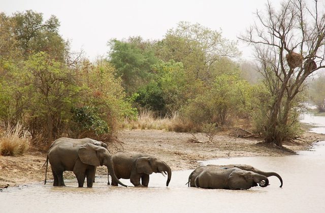
A hunting reserve from 1954, Pendjari was declared a national park in 1961, a biosphere reserve in 1986 and a Ramsar wetland in 2007, and covers about 2,750 square kilometres, with hunting zones round it that bring the protected area to nearly 4,800; in 2017 it was inscribed as a World Heritage Site, as part of the W-Arly-Pendjari complex, which spans Benin, Burkina Faso and Niger and, at more than thirty thousand square kilometres, is the largest intact block of savanna wilderness left in West Africa. It is named after the Pendjari river, which rises in the Atakora hills, flows north, and then swings round in a great arc to form the park's northern and eastern boundary, which is also the frontier, before joining the Volta system; the river shrinks in the dry season to a chain of pools, and the flood plain beside it, with its gallery forest, grasslands and oxbow lakes, is the heart of the park. To the south-east the quartzite cliffs of the Atakora range, up to four hundred metres high, close the view, and the rest is a rolling Sudanian savanna of grassland and open woodland, with shea butter trees, baobabs, tamarinds and borassus palms. The complex holds the largest population of elephants remaining in West Africa, some thousands, of which Pendjari had well over a thousand, and the great majority of the region's surviving lions, perhaps four hundred in all, a genetically distinct western form whose males often have scanty manes;
it was also the last refuge in West Africa of the cheetah, of which a few dozen remain, and had leopards, spotted hyenas, side-striped jackals and occasional wild dogs. Buffalo, of the smaller, redder western savanna form, in herds of several hundred, hippos, the western hartebeest, roan antelope, the korrigum, a very rare western topi, kob, waterbuck, reedbuck, oribi, duikers, warthogs, olive baboons and patas monkeys made up the rest, with some 460 species of birds, among them the saddle-billed stork, the Abyssinian ground hornbill, the African fish eagle, the Pel's fishing owl and the fox kestrel. In 2017 the government of Benin entrusted the park's management for ten years to African Parks, the non-profit organisation that runs reserves in a dozen countries, with substantial funding from foreign foundations; roads, airstrips and a fence on the southern side were built, some 230 rangers were recruited and trained, elephants and lions were fitted with collars, and the numbers of animals and of visitors rose quickly, until the insurgency of the Sahel reached the park's borders. The rangers now find themselves on the front line of that conflict, working alongside the army, and a number have been killed by ambushes and explosive devices. The peoples of the surrounding villages, the Berba, the Gourmantche and the Waama, were moved out of the park at its creation, and retain sacred sites within it; the neighbouring Betammaribe, or Somba, build remarkable two-storey fortified houses of earth, the tata.
When it was open to visitors, the park's season ran from about mid-December to the end of May or early June, the tracks being flooded and the park closed during the rains, from June to October. The best viewing was from February to April, at the height of the dry season, when the grass had been burned, the water had shrunk to the permanent pools and the animals came to them in great numbers; December and January were cooler and hazier, under the dusty harmattan wind, with the vegetation still high, and April and May very hot, 38 to 42 degrees, until the first storms.
The region is malarial, a yellow fever certificate is required for Benin, and tsetse flies are present along the river. For as long as the present insecurity lasts, none of this applies, and no attempt should be made to travel to the park or to the border area north of Natitingou and Tanguieta. Those who wish to support it can follow the work of its managers, and travellers in Benin can safely visit the south and centre of the country, the royal palaces of Abomey, the stilt village of Ganvie and the coast.
No online tour for Pendjari National Park is listed on GetYourGuide; entry, where it is charged, is paid at the gate or through the park authority. Nearby parks with bookable tours are listed on this page.
When it was open to visitors, the park's season ran from about mid-December to the end of May or early June, the tracks being flooded and the park closed during the rains, from June to October.
Pendjari National Park covers 2 755 km².
Pendjari National Park was established in 1961.
Pendjari National Park is in Benin. The map on this page shows the exact spot.
Benin
The W National Park lies at the meeting point of three countries of West Africa, Niger, Benin and Burkina Faso, and…
No online ticket