
Alta Murgia National Park
Apulia, Italy
The Alta Murgia is a high, bare limestone plateau in the interior of Apulia, in the heel of Italy, beginning some forty…
1 ticket or tour
Forest Park · Apulia · Italy
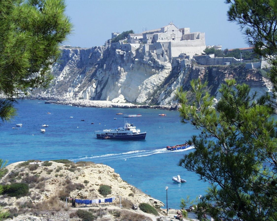
Photo: User:Raboe001, CC BY-SA 3.0 de
The Gargano is the spur of the Italian boot, a mountainous limestone promontory that juts sixty-five kilometres into the Adriatic from the flat plain of northern Apulia, and its national park covers most of it, together with the Tremiti islands offshore and the lagoons on its northern side. It is a holiday region for Italians, above all in August, and little known to foreigners; the nearest airports are Bari, two and a half hours to the south, and Pescara, two hours to the north, the railway reaches only Foggia and Manfredonia at its foot, and a car is more or less essential. There are no gates or fees. The park is best understood as three quite different destinations.
The coast, between the whitewashed towns of Vieste and Mattinata, is a succession of white limestone cliffs, sea caves, natural arches, such as that of San Felice, stacks and small beaches reachable only from the water, and is seen on the boat excursions that leave Vieste, Peschici and Mattinata every morning in summer for a tour of the grottoes, of three hours or so, with swimming stops, or by kayak and paddleboard. The interior is the Foresta Umbra, reached by winding roads from Vieste, Monte Sant'Angelo and Vico, where a visitor centre and small museum, a pond, a deer enclosure and a network of fifteen marked, shady trails, from a gentle half-hour to several hours, make it an ideal escape from the heat of the beach. Horse riding through the forest and the olive country is offered by several stables and farms. The Tremiti islands are reached by ferry or hydrofoil from Termoli, Vieste, Rodi and Peschici, and the pilgrimage towns of Monte Sant'Angelo and San Giovanni Rotondo complete the circuit.
Live dates and prices from GetYourGuide. Free cancellation on most tickets.
The park was established in 1991 and became operational in 1995, covering about 1,180 square kilometres, the largest protected area in Apulia and one of the largest in Italy. The Gargano is geologically an island, a block of Jurassic and Cretaceous limestone that was separate from the peninsula until the plain of the Tavoliere filled in behind it, and it still behaves like one: its plateau, rising to 1,065 metres at Monte Calvo, is riddled with sinkholes, some four thousand dolines, of which the Dolina Pozzatina, more than six hundred metres across and a hundred deep, is among the largest in Europe, and with caves, and its flora is astonishingly rich, with some 2,200 species, more than a third of the whole Italian flora, and the greatest concentration of wild orchids in Europe, about eighty-five species and subspecies. At its heart is the Foresta Umbra, the shady forest, some ten thousand hectares of ancient beech, Turkey oak, hornbeam, maple, yew and holly, with beeches more than three hundred years old and forty metres tall growing, because of the cool, damp microclimate, at far lower altitudes than anywhere else in southern Italy, a phenomenon botanists call depressed beechwood;
part of it was added to the UNESCO World Heritage listing of Europe's ancient beech forests in 2017. It shelters the Italian roe deer in its native form, wildcats, martens, all five Italian woodpeckers that occur in the south, eagle owls and goshawks. On the northern side, the lagoons of Lesina and Varano, separated from the sea by sandbars, and the marshes near Manfredonia hold herons, spoonbills, flamingos and wintering duck. The Tremiti, five small islands twenty-two kilometres offshore, a marine reserve with clear water and good diving, were a place of exile from the time of Augustus, who banished his granddaughter Julia there, to that of Mussolini; San Nicola carries a fortified abbey. The sanctuary of St Michael at Monte Sant'Angelo, a cave where the archangel is said to have appeared in 490, was a great shrine of the Lombards and of pilgrims bound for the Holy Land, and is a World Heritage Site; at San Giovanni Rotondo millions visit the tomb of Padre Pio.
The park is open at all times, and the coastal boat trips run from about May to September. Late April to June is the best period, with the orchids and other flowers at their height, the forest fresh and the sea warming; September and early October are warm, clear and quiet; in July and especially August the coast is crowded, accommodation is expensive and booked long in advance, and the cool of the Foresta Umbra, several degrees below the beach, is at its most welcome;
winter is mild on the coast, with snow on the plateau some years, and many hotels and restaurants closed. The pilgrimage sites are busy on Sundays and feast days. Allow three to four days. Vieste and Peschici are the coastal bases, Monte Sant'Angelo the inland one, the Swabian castle of Lucera and Castel del Monte to the south-west, and Trani and Bari down the coast.
Yes. GetYourGuide lists 2 tickets and tours for Gargano National Park, with live dates and prices and free cancellation on most of them.
The park is open at all times, and the coastal boat trips run from about May to September.
Allow three to four days.
Gargano National Park covers 1 181 km².
Gargano National Park was established in 1991.
Gargano National Park is in Apulia, Italy. The map on this page shows the exact spot.
Apulia, Italy
The Alta Murgia is a high, bare limestone plateau in the interior of Apulia, in the heel of Italy, beginning some forty…
1 ticket or tour