
Noosa National Park
39 km away
Noosa National Park begins where Hastings Street, the smart beachfront strip of Noosa Heads on Queensland's…
5 tickets & tours
Waterfall & Lake Park · Queensland · Australia
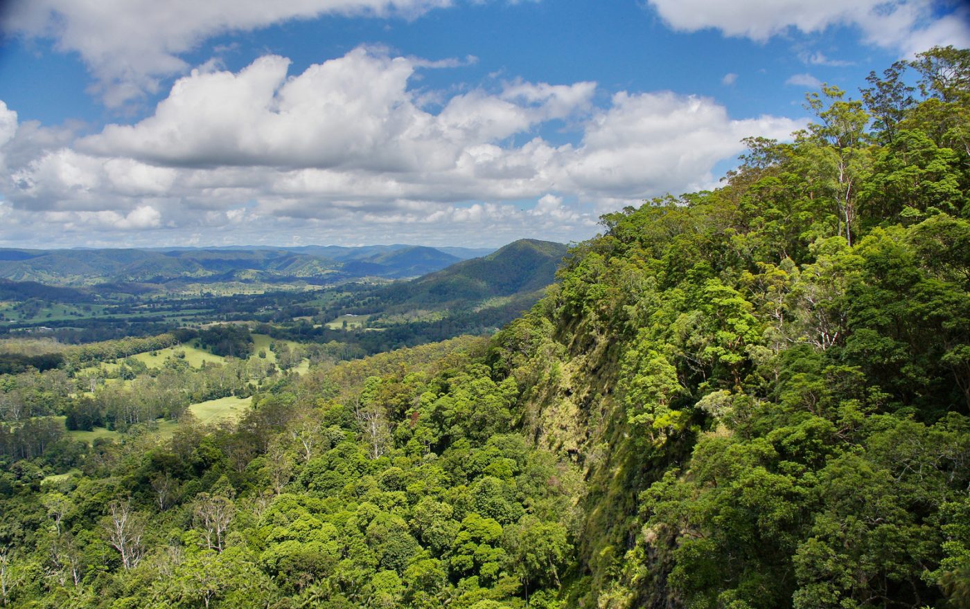
Photo: Tatters ✾ from Brisbane, Australia, CC BY-SA 2.0
Mapleton Falls is one of the smallest national parks in Queensland, a pocket of rainforest and eucalypt forest round a single waterfall on the edge of the Blackall Range, in the green hinterland of the Sunshine Coast, about a hundred kilometres, an hour and a half by road, north of Brisbane and half an hour inland from the beaches of Maroochydore and Mooloolaba. It is a stop, not a destination in itself, and it fits naturally into a day's drive along the crest of the range, the so-called Blackall Range tourist drive, through the villages of Maleny, Montville, Flaxton and Mapleton, which are known for their views of the coast and the Glass House Mountains, their craft galleries, cafes and gardens, and which can be followed with a hired car or on one of the hinterland day tours from the coast or from Brisbane. The park lies four kilometres west of the little town of Mapleton, along Obi Obi Road, and is free and open at all hours.
A small car park, with picnic tables, barbecues and toilets set in a grassy clearing, stands at the top of the falls, and only a few steps away a fenced lookout platform, accessible to wheelchairs, projects over the edge of the escarpment, giving a view down the face of the falls and, more strikingly, out over the forested Obi Obi valley to the ranges beyond. The one walking track, the Wompoo circuit, a loop of 1.3 kilometres and about forty-five minutes on a good path with some gentle slopes, leaves the picnic area and winds through rainforest and tall open forest, with a second lookout over the valley. For a longer walk, the park is one of the access points of the Sunshine Coast hinterland Great Walk, a track of fifty-eight kilometres, usually done in four days, which links it with Kondalilla Falls, a larger and more dramatic park ten minutes' drive to the south, and with the Mapleton forest.
Live prices from GetYourGuide for tours whose route includes this park. Free cancellation on most of them.
The falls were reserved for public recreation in the early years of settlement and became a national park in 1973, the date of 2001 appearing in some lists being that of a later regazettal; the park covers only about twenty-six hectares, though it adjoins the much larger Mapleton National Park and forest reserve to the north and west. Here Pencil Creek, a small stream that rises in the farmland on top of the range, reaches the brink of the escarpment and drops some 120 metres down a cliff of dark basalt into the valley of Obi Obi Creek, a tributary of the Mary river. It should be said that the waterfall itself is seen only obliquely from the lookout, from above and to one side, and that in dry weather it may shrink to a trickle; it is after heavy rain, when it becomes a roaring white column and cloud drifts through the valley below, that it is worth a special journey. The Blackall Range is the remnant of a plateau of basalt lava, erupted some twenty-five to thirty million years ago, whose deep, red, fertile soils once carried one of the richest subtropical rainforests in southern Queensland, full of red cedar, white beech, hoop pine and bunya pine. The timber-getters arrived in the 1860s, floating the cedar logs down the Mary and Maroochy rivers, the settlers who followed cleared almost everything that remained for dairy farms, citrus orchards and pineapples, and the patches of forest in the national parks of the range are precious survivors of what was lost.
For the Aboriginal people the range had a special importance: the Kabi Kabi and the Jinibara, its traditional owners, were the hosts of the great bunya gatherings, held every three years or so when the bunya pines of the Blackall Range bore a heavy crop of their large, nutritious nuts, to which groups travelled on foot from hundreds of kilometres away, under safe conduct, to feast, trade, arrange marriages, settle disputes and hold ceremonies, a custom that ended with the clearing of the forests. The Wompoo circuit takes its name from the wompoo fruit-dove, a large and splendid pigeon, green above, with a plum-purple breast and yellow belly, whose deep, resonant, two-note call, which sounds like its name, carries through the forest, and which feeds on the fruits of figs and palms in the canopy. The little park has a list of more than a hundred species of birds, among them the eastern whipbird, the green catbird, which wails like a child, the noisy pitta, the paradise riflebird, the brush turkey and, soaring along the cliffs on the updraughts, the peregrine falcon, which has nested near the falls, and the wedge-tailed eagle. Piccabeen palms, strangler figs, blackbutts, brush boxes and tall flooded gums make up the forest, pademelons and echidnas may be seen at dusk, and the streams hold freshwater crayfish.
The park is open all year. The falls are at their best during and after the wet season, from December to March, and following any period of heavy rain, when the volume of water is greatest and mist fills the valley; this is, however, the hottest and most humid time, with thunderstorms, leeches on the track and occasionally the closure of roads on the range by fallen trees or landslips. The cooler, drier months, from May to September, offer clear air, the widest views, comfortable temperatures of 15 to 22 degrees on the range, several degrees below the coast, and crisp mornings, but the falls are then often reduced.
Early morning is the best time for birds and for having the lookout to oneself, weekends bringing many picnickers from the coast. Keep behind the fences, since the cliff edge is sheer and people have been killed at waterfalls on the range by climbing barriers. Bring insect repellent and a light jacket. Allow an hour. Kondalilla Falls is ten minutes away, Montville fifteen, Maleny and the Mary Cairncross rainforest reserve half an hour, and Australia Zoo forty minutes.
39 km away
Noosa National Park begins where Hastings Street, the smart beachfront strip of Noosa Heads on Queensland's…
5 tickets & tours
170 km away
Lamington lies on a high plateau of the McPherson Range, on the border of Queensland and New South Wales, in the…
2 tickets & tours
173 km away
Springbrook is a high, wet, forested plateau in the hinterland of the Gold Coast, in the south-east corner of…
1 ticket or tour
Yes. GetYourGuide sells tickets and guided tours whose route includes Mapleton Falls National Park; live prices are shown on this page.
The park is open all year.
Early morning is the best time for birds and for having the lookout to oneself, weekends bringing many picnickers from the coast.
Mapleton Falls National Park covers 0.3 km².
Mapleton Falls National Park was established in 1973.
Mapleton Falls National Park is in Queensland, Australia. The map on this page shows the exact spot.
Queensland, Australia
Green Island is a tiny coral cay on the Great Barrier Reef, twenty-seven kilometres off the city of Cairns in tropical…
7 tickets & tours
Queensland, Australia
Noosa National Park begins where Hastings Street, the smart beachfront strip of Noosa Heads on Queensland's…
5 tickets & tours
Queensland, Australia
Great Sandy National Park, on the coast of southern Queensland, consists of two separate sections which visitors…
2 tickets & tours
Queensland, Australia
Lamington lies on a high plateau of the McPherson Range, on the border of Queensland and New South Wales, in the…
2 tickets & tours
Queensland, Australia
The Whitsundays are a group of seventy-four islands lying just off the coast of central Queensland, inside the Great…
2 tickets & tours
Queensland, Australia
Barron Gorge is the deep, rainforested ravine by which the Barron river drops from the Atherton tableland to the…
1 ticket or tour


