
Fiordland National Park
New Zealand
Fiordland covers the whole south-western corner of the South Island of New Zealand, the largest national park in the…
81 tickets & tours
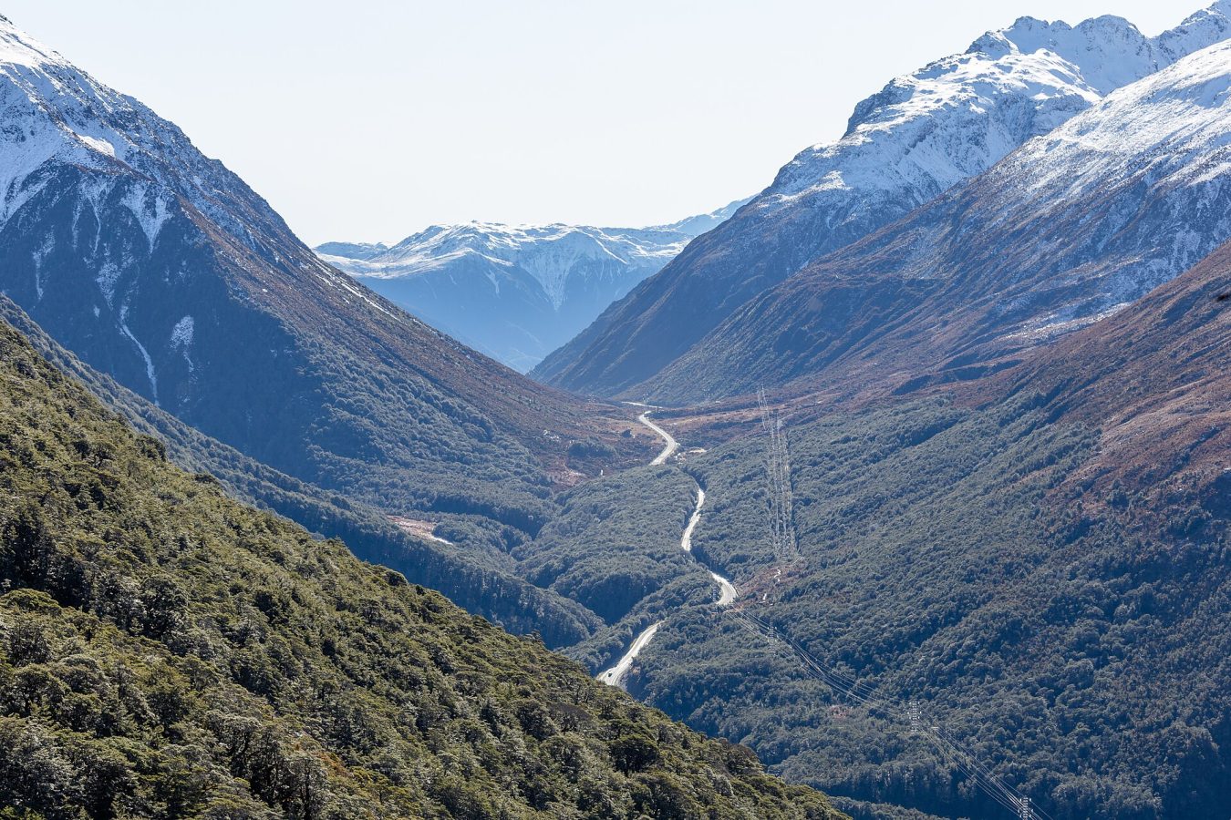
Photo: Michal Klajban, CC BY-SA 4.0
Arthur's Pass is the mountain park on the main divide of New Zealand's South Island, two hours from Christchurch on the road to the West Coast, and it is visited in three ways: the TranzAlpine train, the day tour by road and the car. The TranzAlpine, one of the famous rail journeys of the world, crosses the Canterbury plains and the Waimakariri gorges to Arthur's Pass village in two and a half hours and continues through the Otira tunnel to Greymouth; the day tours use it one way and a coach the other, with stops at Castle Hill's limestone boulders, the Cave Stream reserve and Lake Pearson on the road, a walk to the Devils Punchbowl waterfall from the village and the afternoon train back, which is the best single day out of Christchurch.
The small-group and private tours by road do the same stops with more time at Castle Hill and a second walk, and the alpine-and-farm versions add a high-country sheep station with lunch and a jet boat on the Waimakariri. There is no entrance fee, and the Department of Conservation visitor centre in the village has the track and weather information that the park's serious routes need. Independent visitors drive State Highway 73, walk the short tracks from the village and the pass, and take the longer routes, Avalanche Peak above all, only in settled weather with proper boots; the buses between Christchurch and Greymouth stop in the village.
Live dates and prices from GetYourGuide. Free cancellation on most tickets.
The park was established in 1929, the first in the South Island and the third in New Zealand, after the railway excursionists had stripped the rātā blooms of the Otira gorge, and it covers 1,185 square kilometres of the Southern Alps astride the main divide, with the pass itself at 920 metres carrying the road and, in a tunnel of eight and a half kilometres below it, the railway. The divide makes two parks: the eastern side in the rain shadow has wide shingle riverbeds, the braided Waimakariri and the Poulter, with mountain beech forest on the valley sides and tussock above; the western side, with five metres of rain a year, drops through the Otira gorge in dense podocarp rainforest, red with southern rātā in a flowering summer, and the road descends it over the Otira viaduct of 1999 with the waterfall chuted over the carriageway.
The village, a strip of huts that began as the tunnellers' camp, is the base for the walks: the Devils Punchbowl falls, 131 metres, half an hour up a stairway track through the beech; the Bridal Veil and the Bealey valley walks; the Temple Basin ski field track; and Avalanche Peak, 1,833 metres, the only summit in the park with a marked route from the village, a climb of 1,100 metres with Mount Rolleston and the Crow glacier across the valley, which kills the unprepared in bad weather. The kea, the alpine parrot, is the park's character, intelligent, tame and destructive of windscreen rubbers and boots left outside huts; the great spotted kiwi calls in the forest at night, the whio blue duck lives on the torrents, and the rock wren on the screes. Castle Hill on the road from Christchurch, a basin of limestone tors that the Dalai Lama called a spiritual centre of the universe, belongs to the journey rather than the park.
The park is open at all times, with the visitor centre from 8.30 am to 4.30 pm, and the road over the pass is open all year but closed by snow or slips for hours or days in winter storms, with chains required. Summer from December to March is the walking season, with the rātā in flower in January and the long days; autumn is settled and clear; winter from June to September brings snow to the village, the club ski field at Temple Basin and ice on the tracks;
spring is the avalanche season on the higher routes. The weather on the divide turns in an hour, and the forecast at the visitor centre is the one to believe. Allow a full day from Christchurch, two nights for Avalanche Peak. The West Coast's Hokitika gorge and Punakaiki rocks are an hour and a half beyond the pass, and Christchurch is two hours east.
Yes. GetYourGuide lists 13 tickets and tours for Arthur’s Pass National Park, with live dates and prices and free cancellation on most of them.
There is no entrance fee, and the Department of Conservation visitor centre in the village has the track and weather information that the park's serious routes need.
There is no entrance fee, and the Department of Conservation visitor centre in the village has the track and weather information that the park's serious routes need.
The park is open at all times, with the visitor centre from 8.30 am to 4.30 pm, and the road over the pass is open all year but closed by snow or slips for hours or days in winter storms, with chains required.
Allow a full day from Christchurch, two nights for Avalanche Peak.
Arthur’s Pass National Park covers 1 185 km².
Arthur’s Pass National Park was established in 1929.
Arthur’s Pass National Park is in New Zealand. The map on this page shows the exact spot.
New Zealand
Fiordland covers the whole south-western corner of the South Island of New Zealand, the largest national park in the…
81 tickets & tours
New Zealand
Aoraki / Mount Cook National Park contains the highest mountains and the longest glaciers of New Zealand, in the centre…
68 tickets & tours
New Zealand
Westland Tai Poutini National Park lies on the wet western side of the Southern Alps, in the South Island of New…
49 tickets & tours
New Zealand
Abel Tasman is the coastal park at the top of New Zealand's South Island, an hour from Nelson to the gateway…
16 tickets & tours
New Zealand
Tongariro is the volcanic heart of New Zealand's North Island, four and a half hours'
6 tickets & tours
New Zealand
Kahurangi fills the north-western corner of the South Island of New Zealand, a vast, roadless tangle of mountains,…
1 ticket or tour


