
Fiordland National Park
New Zealand
Fiordland covers the whole south-western corner of the South Island of New Zealand, the largest national park in the…
81 tickets & tours
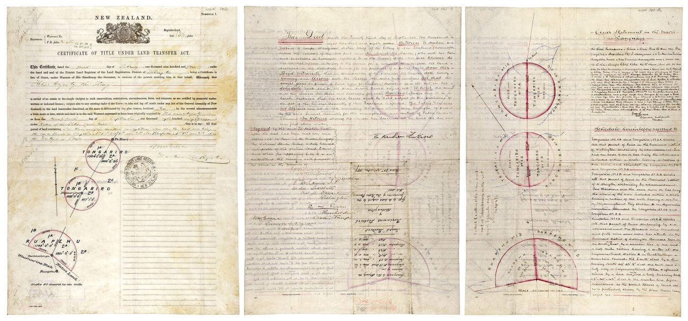
Photo: Archives New Zealand from New Zealand, CC BY-SA 2.0
Tongariro is the volcanic heart of New Zealand's North Island, four and a half hours' drive from Auckland or Wellington and an hour from Taupō, and what most people come for is a single walk, the Tongariro Alpine Crossing, 19.4 kilometres across the saddle between two active volcanoes, generally called the best one-day hike in the country. It is a one-way route, from the Mangatepōpō car park at 1,120 metres to Ketetahi at 760, six to eight hours, and the logistics are the thing to arrange: parking at the start is limited to four hours in the season, precisely to prevent walkers leaving cars there, so that nearly everyone uses a licensed shuttle, either a return service from the villages of National Park, Whakapapa, Tūrangi or Taupō, or the park-and-ride from the Ketetahi end, which carries you to the start to walk back to your car at your own pace.
Since 2023 walkers must also register their trip in advance on the Department of Conservation's booking system, which is free, and a charge for international visitors has been under discussion, so check before going. Guided crossings, with a guide, extra clothing and transport, are good value for the inexperienced and the only safe form in winter, from about May to October, when the route is under snow and ice and requires crampons, ice axe and avalanche awareness. Shorter guided and self-guided walks from Whakapapa Village, to Taranaki Falls in two hours or the Tama Lakes in five or six, show the same country without the commitment, and the Sky Waka gondola on Ruapehu lifts non-walkers to 2,020 metres. The long day tours from Auckland are mostly a drive.
Live dates and prices from GetYourGuide. Free cancellation on most tickets.
Tongariro is the oldest national park in New Zealand and the sixth in the world, and the manner of its founding is unique: in 1887 Horonuku Te Heuheu Tūkino IV, paramount chief of Ngāti Tūwharetoa, gave the sacred summits of Tongariro, Ngāuruhoe and Ruapehu to the Crown on behalf of all the people, to prevent their being carved up and sold. It covers some 796 square kilometres and has been a World Heritage Site since 1990 for its volcanoes and, since 1993, the first in the world to be listed also as a cultural landscape, for its meaning to Māori. All three mountains are active. Ruapehu, 2,797 metres, the highest point of the North Island, carries its only glaciers, two commercial ski fields and a hot, acid crater lake, which erupted in 1995 and 1996 and whose collapse in 1953 sent a lahar down the Whangaehu river that swept away a railway bridge minutes before the Wellington to Auckland express arrived, killing 151 people on Christmas Eve.
Ngāuruhoe, 2,291 metres, a perfect, bare, symmetrical cone, in fact a young vent of Tongariro, last erupted in 1975 and played Mount Doom in the Lord of the Rings films; its summit is sacred, and visitors are asked not to climb it. Tongariro itself, a sprawl of craters, erupted at Te Maari in 2012, throwing rocks through the roof of the Ketetahi hut. The Crossing climbs the Devil's Staircase to the South Crater, a flat pan of yellow mud, then to the rim of the Red Crater, at 1,886 metres the highest point, raw red and black with a gaping dyke, and slides down loose scoria to the three Emerald Lakes, coloured by dissolved minerals and ringed with steaming vents, and the larger Blue Lake, before the long descent through tussock and forest with Lake Taupō ahead. The tussock, beech forest and alpine herbfields shelter blue ducks, kiwi, kārearea falcons and the native bats.
The park is open all year. The walking season for the Crossing is roughly November to April, with December to March the most settled and the busiest, when two to three thousand people may cross on a fine Saturday; the shuttles cancel when the forecast is bad, and their judgement should be accepted, since the saddle is fully exposed and conditions change within an hour, with snow possible in midsummer.
Start early, carry warm and waterproof layers, food and at least two litres of water, for there is none on the route. Winter brings the ski season on Ruapehu, from late June to October. Allow two nights nearby for a weather window. Taupō and the Huka Falls are an hour north, the Waitomo caves two hours north-west, and Whanganui National Park's river journey begins at Taumarunui.
Yes. GetYourGuide lists 6 tickets and tours for Tongariro National Park, with live dates and prices and free cancellation on most of them.
The park is open all year.
Allow two nights nearby for a weather window.
Tongariro National Park covers 796 km².
Tongariro National Park was established in 1887.
Tongariro National Park is in New Zealand. The map on this page shows the exact spot.
New Zealand
Fiordland covers the whole south-western corner of the South Island of New Zealand, the largest national park in the…
81 tickets & tours
New Zealand
Aoraki / Mount Cook National Park contains the highest mountains and the longest glaciers of New Zealand, in the centre…
68 tickets & tours
New Zealand
Westland Tai Poutini National Park lies on the wet western side of the Southern Alps, in the South Island of New…
49 tickets & tours
New Zealand
Abel Tasman is the coastal park at the top of New Zealand's South Island, an hour from Nelson to the gateway…
16 tickets & tours
New Zealand
Arthur's Pass is the mountain park on the main divide of New Zealand's South Island, two hours from…
13 tickets & tours
New Zealand
Kahurangi fills the north-western corner of the South Island of New Zealand, a vast, roadless tangle of mountains,…
1 ticket or tour


