Marine Park · Antigua and Barbuda
Devil’s Bridge National Park
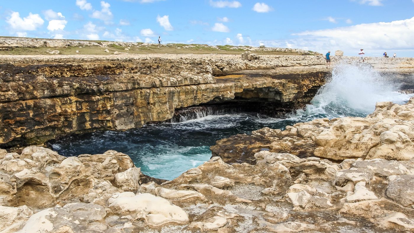
Photo: Dr. Thomas Liptak, CC BY-SA 4.0
- Type
- Marine Park
- Where
- Antigua and Barbuda
- Tickets
- 1 ticket or tour
Devil's Bridge National Park tickets and tours: which one to book
Devil's Bridge is a natural limestone arch on the wild Atlantic coast of Antigua, at the north-eastern tip of the island near the village of Willikies and the resort area of Long Bay, about forty minutes by road from the capital, St John's, and its cruise-ship quay, and it should not be confused with the many other devil's bridges of the world, in Switzerland, Tuscany, Lake Como and Wales, which share its name in searches. It is a small site, free to enter, without gates, railings or facilities beyond a rough car park and, usually, a few stalls selling souvenirs and cold drinks, at the end of a bumpy dirt track off the Long Bay road, and a visit lasts twenty minutes to half an hour.
It therefore figures as one stop on the island tours sold to cruise passengers and hotel guests, by minibus, open safari truck or jeep, which commonly combine it with Betty's Hope, the restored sugar plantation with its twin windmills a few minutes inland, a swim at Long Bay beach, and, on the longer tours, a boat trip to Stingray City, a sandbar in the shallow sea off Seatons where southern stingrays are fed and visitors stand among them, or a drive on to Nelson's Dockyard and Shirley Heights in the south. With a hire car it is easy to find and pairs naturally with the half-day at Long Bay, which has calm water, a reef for snorkelling and beach bars. One warning is not a formality: do not walk across the bridge. The rock is wet, sharp and slippery, waves break over it without notice, and people have been swept off and killed.
Tickets and tours for Devil’s Bridge National Park
Live dates and prices from GetYourGuide. Free cancellation on most tickets.
Visiting Devil's Bridge National Park: what you will see
The arch stands at the end of a low, bare headland of pale, pitted limestone, the Antigua Formation, laid down as coral reef some thirty million years ago, on the side of the island that faces the open Atlantic, where the trade-wind swell, with nothing between here and Africa, has over thousands of years cut under a ledge of harder rock until it broke through, leaving a span about ten metres long and a couple of metres above the sea, under which the waves surge and boom. Around it the rock is riddled with cracks and blowholes, and when a big swell is running, as it does for much of the winter, water is forced up through them and shoots into the air in geysers of spray, soaking the unwary; at such times the whole headland is a fine show of white water, turquoise shallows and deep blue ocean. The landscape behind is dry, windswept scrub of sea grape, acacia, century plants and Turk's-cap cactus, quite unlike the sheltered beaches of the leeward coast.
The place was declared a national park by the government of Antigua and Barbuda in the 2000s, and it is a small park with a heavy meaning. The name is explained, in a much-quoted account by the Antiguan writer Sammy Smith in the memoir To Shoot Hard Labour, by the island's history of slavery: enslaved Africans from the neighbouring estates are said to have come here to throw themselves into the sea, believing that the water would carry them home to Africa, and so many died that people said the devil must live there. Whether or not it happened in the numbers tradition claims, the site is treated by Antiguans as a memorial to the enslaved, and the story is told to every visitor. The sugar estates it refers to covered this whole district; Betty's Hope, founded in the 1650s and owned by the Codrington family for nearly three centuries, was the largest on the island. The coast nearby has several quiet coves, and the offshore islets of the North Sound are nesting grounds for seabirds and turtles.
Devil's Bridge National Park: best time to go, seasons and hours
The site is open at all times and is unattended. Antigua is warm all year, 25 to 31 degrees, with the drier, breezier season from December to April, when the Atlantic swell is strongest and the blowholes most active, and the hotter, wetter, stiller months from June to November, which are also the hurricane season. Morning light is best on the arch, which faces east, and the cruise-ship tours mostly arrive between ten and two.
Wear shoes with soles, since the rock is razor-sharp karst, keep children close, stay well back from the edge, and never turn your back on the sea. Allow half an hour, a half-day with Long Bay and Betty's Hope. Long Bay beach is five minutes away, Betty's Hope ten, Stingray City at Seatons fifteen, and St John's forty.
More tours and activities in Antigua and Barbuda
Before you go
Can I book a tour or safari in Devil’s Bridge National Park online?
Yes. GetYourGuide lists one ticket or tour for Devil’s Bridge National Park, with live dates and prices and free cancellation on most of them.
Is Devil’s Bridge National Park free to visit?
It is a small site, free to enter, without gates, railings or facilities beyond a rough car park and, usually, a few stalls selling souvenirs and cold drinks, at the end of a bumpy dirt track off the Long Bay road, and a visit lasts twenty minutes to half an hour.
When is Devil’s Bridge National Park open?
The site is open at all times and is unattended.
How many days do you need in Devil’s Bridge National Park?
Allow half an hour, a half-day with Long Bay and Betty's Hope.
Where is Devil’s Bridge National Park?
Devil’s Bridge National Park is in Antigua and Barbuda. The map on this page shows the exact spot.