Ulu Temburong National Park
65 km away
Ulu Temburong is a tract of untouched Bornean rainforest in the hilly south of Temburong, the eastern district of the…
1 ticket or tour

Photo: Nur Nafis Naim, CC BY-SA 4.0
Gunung Mulu, in the interior of the Malaysian state of Sarawak in northern Borneo, close to the border of Brunei, contains some of the largest caves on earth in the middle of untouched rainforest, and it is one of the best organised and most rewarding national parks in South-East Asia. It is reached, in practice, only by air: small turboprop aircraft fly daily to the airstrip at Mulu from Miri, half an hour away, and from Kuching and Kota Kinabalu, there being no road, and the alternative, a river journey of a full day from Miri, is rarely used. The park headquarters, a few minutes from the airstrip, has an office where the entrance fee, valid for five days, is paid and all activities are booked, a cafe, a range of accommodation from hostel beds to chalets, which sell out in the season, and there are a resort hotel and simple homestays outside the gate.
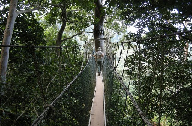
All visits to the caves are made with the park's own guides, in groups of limited size, at fixed times, and should be reserved ahead through the park's website. Four show caves, with concrete paths and lighting, are seen on two half-day tours. Deer cave and Lang cave, visited in the afternoon, are reached by a level boardwalk of three kilometres through the forest, and the tour ends at an open-air amphitheatre outside the cave mouth, where everyone waits for the bats to emerge at dusk. Clearwater cave and Wind cave, visited in the morning, are reached by longboat up the Melinau river, with a stop at a Penan settlement, and the trip ends with a swim in the crystal pool where the underground river emerges. There is also a canopy walkway 480 metres long, night walks, and, for the fit, introductory to advanced adventure caving, the three-day trek to the limestone Pinnacles, the four-day climb of Mount Mulu, and the Headhunters' trail out to Limbang.
Live prices from GetYourGuide for tours whose route includes this park. Free cancellation on most of them.
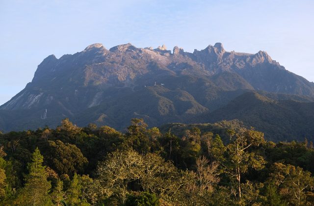
The national park was constituted in 1974 and opened to the public in 1985, covers 529 square kilometres, and was inscribed as a World Heritage Site in 2000, satisfying all four of the natural criteria, which very few sites do. It is dominated by two mountains of quite different character, Gunung Mulu itself, 2,377 metres, a sandstone massif clothed in forest from foot to mossy summit, and, beside it, the limestone ranges of Gunung Api, the fire mountain, and Gunung Benarat, raised from a sea bed some forty million years ago, soaked by five metres and more of rain a year, and dissolved by it into the most spectacular tropical karst in the world. More than 295 kilometres of cave passages have been surveyed beneath them, by a series of British expeditions which began in 1977 with a great scientific survey led by the Royal Geographical Society and continue to this day, and it is thought that as much again remains to be found. Deer cave, named after the deer that used to shelter in it to lick salt from the rocks, has the largest cave passage known on earth, two kilometres long and nowhere less than ninety metres high and wide, reaching 174 metres in height at its southern entrance, large enough to hold several cathedrals, with waterfalls dropping from the roof after rain and, seen from inside against the light, a rock profile uncannily like that of Abraham Lincoln.
Between two and three million wrinkle-lipped bats, of a dozen species, roost in its roof, and on most fine evenings between five and half past six they pour out in a succession of long, twisting ribbons and spirals, each of tens of thousands of bats, which stream away over the forest to feed, while bat hawks wait to pick them off; they eat, it is calculated, tons of insects every night. Their guano, metres deep on the cave floor, supports a whole community of cockroaches, earwigs, crabs and centipedes. The Clearwater system, more than two hundred kilometres long, is among the ten longest caves in the world, with a river running through it, and Sarawak chamber, discovered in 1981 in another cave and reached only by expert cavers, is the largest known underground chamber by area, seven hundred metres long, four hundred wide and at least seventy high. On the flank of Gunung Api, at about 1,200 metres, the Pinnacles, a forest of razor-sharp grey limestone blades up to forty-five metres tall, stand above the trees, reached by a climb of exceptional steepness with ladders and ropes. The forests, of seventeen vegetation types from peat swamp to montane moss forest, hold some 3,500 species of plants, among them more than a hundred palms and many pitcher plants, all eight of Borneo's hornbills, gibbons, bearded pigs, sun bears, twenty thousand or more species of invertebrates, and frogs by the dozen. The nomadic Penan, hunters with blowpipes, and the Berawan are the people of the area, and many work as guides.
The park is open all year, and since it is one of the wettest places in Borneo, rain is to be expected at any season, usually in heavy bursts in the afternoon and at night; there is no real dry season, though June to September and February to April tend to be somewhat drier, and the heaviest rain generally falls from October to January, when the river may rise and flood the boardwalks or, in drought, fall too low for the boats. The bats do not come out in rain, so allow at least two evenings to improve the chance of seeing them.
July and August and the local school holidays are the busiest times, when flights, beds and tours should be booked months ahead. It is hot and humid, 24 to 32 degrees, and cooler inside the caves. Bring light clothing, shoes with a good grip, a torch, a waterproof, insect repellent and leech socks for the longer trails. The Pinnacles trek demands real fitness, and walkers who fail to reach a checkpoint by a set time are turned back. Allow three days, five with the Pinnacles. Miri and the Niah caves are the natural continuation.
65 km away
Ulu Temburong is a tract of untouched Bornean rainforest in the hilly south of Temburong, the eastern district of the…
1 ticket or tour
310 km away
Kinabalu Park surrounds the highest mountain in Borneo, two hours by road from Kota Kinabalu, the capital of the…
5 tickets & tours
Yes. GetYourGuide sells tickets and guided tours whose route includes Gunung Mulu National Park; live prices are shown on this page.
The park headquarters, a few minutes from the airstrip, has an office where the entrance fee, valid for five days, is paid and all activities are booked, a cafe, a range of accommodation from hostel beds to chalets, which sell out in the season, and there are a resort hotel and simple homestays outside the gate.
Allow three days, five with the Pinnacles.
Gunung Mulu National Park covers 529 km².
Gunung Mulu National Park was established in 1974.
Gunung Mulu National Park is in Malaysia. The map on this page shows the exact spot.
Malaysia
Taman Negara, the name simply means national park in Malay, is the great rainforest of the Malay Peninsula, and nearly…
8 tickets & tours
Malaysia
Kinabalu Park surrounds the highest mountain in Borneo, two hours by road from Kota Kinabalu, the capital of the…
5 tickets & tours
Malaysia
Bako is the oldest and smallest of Sarawak's national parks, at the tip of a peninsula thirty-seven kilometres…
4 tickets & tours
Malaysia
Kubah is a small rainforest park on a sandstone ridge about twenty-two kilometres, forty minutes by road, west of…
2 tickets & tours