Pieniny National Park
76 km away
Pieniny is a very small park in the far south of Poland, on the Slovak border two hours from Kraków and an hour east of…
5 tickets & tours
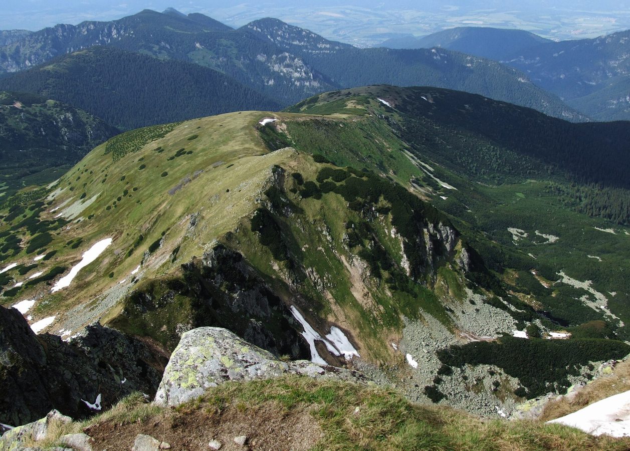
Photo: Pudelek (Marcin Szala), CC BY-SA 3.0
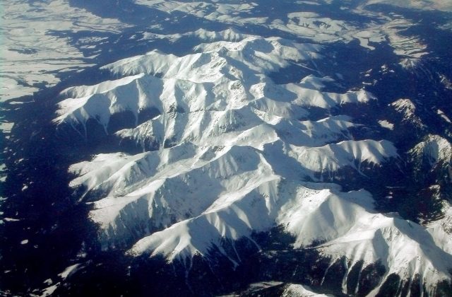
The Low Tatras are the second highest mountains of Slovakia, a single long ridge running east and west for some eighty kilometres across the centre of the country, between the valleys of the Vah, to the north, and the Hron, to the south, and their national park is the largest in Slovakia, wilder, more wooded and far less crowded than the better known High Tatras, which face them across the Vah. They are easily reached: the main railway and motorway between Bratislava and Kosice follow the Vah along their northern foot, with stations at Ruzomberok, Liptovsky Mikulas and Poprad, the last of which has an airport, and Banska Bystrica and Brezno serve the southern side; buses run up the principal valleys. Entry is free. The park divides naturally into two halves at the pass of Certovica.
The western half is the higher and more visited, and its centre is the Demanovska valley, a quarter of an hour by bus from Liptovsky Mikulas, which contains, close together, two of the finest show caves in Europe, the Demanovska cave of liberty, a tour of an hour or more through halls of pink, white and red dripstone along an underground river, and the Demanovska ice cave, and, at its head, the resort of Jasna, the largest ski area in Slovakia, from which a chain of modern cable cars climbs in all seasons to the summit of Chopok, 2,024 metres, on the main ridge, and descends the southern side to Srdiecko. From Chopok the ridge path leads westwards in about an hour and a half to Dumbier, the highest summit, and eastwards to Derese and beyond, and one can walk down to a mountain hut and return by another valley. The classic long walk is the traverse of the whole main ridge, the Path of the Heroes of the Slovak National Uprising, five to six days from Telgart to Donovaly with nights in mountain huts. The eastern half, round Kralova hola, is remote and little visited.
Live prices from GetYourGuide for tours whose route includes this park. Free cancellation on most of them.
The national park was declared in 1978 and covers about 728 square kilometres, with a protective zone of a further 1,100, which makes it the largest protected area in the country. The main ridge, smooth, broad and grassy, stays above 1,500 metres for most of its length and rises to 2,043 metres at Dumbier; its core is of granite and gneiss, which gives the rounded summits and the glacial cirques cut into their northern faces, while the northern and southern foothills are built of limestone and dolomite, which the water has dissolved into deep, narrow valleys, gorges, sinkholes and one of the most important cave districts of central Europe. The Demanovska valley alone has a system of passages on nine levels, more than forty kilometres in length, the longest in Slovakia, of which the cave of liberty, discovered in 1921, is celebrated for its calcite waterfalls, its lily-shaped lake formations and its cave pearls, and the ice cave, known since the thirteenth century and described in print in 1719, holds permanent ice in its lower chambers and the signatures of visitors three centuries old. Other show caves, Bystrianska, the Cave of the Dead Bats and the aragonite cave of Vazec, lie round the edges of the range. Forests of beech and fir, and higher up of spruce, cover the slopes to about 1,500 metres, above which come belts of dwarf pine and alpine meadow, where the pasque flower, gentians, auriculas and the Carpathian bellflower bloom.
These forests are among the great strongholds of European wildlife: the park and its surroundings hold one of the densest populations of brown bears on the continent, several hundred animals, together with wolves, lynx, wildcats, red deer, capercaillie, black grouse, golden eagles and the three-toed woodpecker; on the ridge live the Tatra chamois, a subspecies brought here from the High Tatras between 1969 and 1976 as an insurance against its extinction there, and the alpine marmot. Four great rivers of Slovakia, the Vah, the Hron, the Hnilec and the Hornad, rise on the slopes of Kralova hola, the king's bald mountain, 1,946 metres, the legendary hideout of the outlaw Janosik, the Slovak Robin Hood. The mountains have a heroic place in modern history: in the autumn of 1944, when the Germans crushed the Slovak National Uprising, centred on Banska Bystrica, thousands of insurgents and partisans retreated into the Low Tatras, crossing the main ridge in snowstorms in which many froze to death, and held out in the valleys through the winter; memorials stand on the passes and in the valleys, and the ridge path bears their name. In recent decades the expansion of the ski resort of Jasna, heavy logging after storms and bark beetle outbreaks, and conflicts between bears and people in the villages have been the park's chief controversies.
The park is open all year. The walking season runs from June to October: June is fresh and flowery, with snow patches lingering on the northern slopes, July and August are the warmest months, 12 to 18 degrees on the ridge, with frequent afternoon thunderstorms, which are dangerous on the long, exposed crest, so that an early start is essential, and September and early October are the most settled, with clear air and autumn colour in the beech woods. The cable cars to Chopok run all year except for maintenance periods in spring and late autumn, and the show caves are open from about mid-May or June to September or October, some of them all year, and are closed on Mondays.
From December to April Jasna is a busy ski resort, and the ridge, which carries cornices and avalanche slopes, is for experienced ski tourers only. Walkers should make a noise in the forest, keep food sealed, and know how to behave on meeting a bear. Bring windproof and warm clothing, and a jacket for the caves. Allow two to four days. The wooden church of Svaty Kriz, the village of Vlkolinec, a World Heritage Site, and the thermal baths of Liptov are all near by.
76 km away
Pieniny is a very small park in the far south of Poland, on the Slovak border two hours from Kraków and an hour east of…
5 tickets & tours
186 km away
The Hortobagy is the great treeless plain of eastern Hungary, the puszta of song and legend, and its national park lies…
1 ticket or tour
Yes. GetYourGuide sells tickets and guided tours whose route includes Low Tatras National Park; live prices are shown on this page.
The park is open all year.
Allow two to four days.
Low Tatras National Park covers 728 km².
Low Tatras National Park was established in 1978.
Low Tatras National Park is in Slovakia. The map on this page shows the exact spot.
Slovakia
The Slovak Paradise, Slovensky raj, is a small limestone plateau in the east of Slovakia, south of the High Tatras, cut…
No online ticket
Slovakia
The Slovak Tatra National Park, known by its initials as TANAP, covers the southern and larger side of the Tatra…
No online ticket