Pieniny National Park
57 km away
Pieniny is a very small park in the far south of Poland, on the Slovak border two hours from Kraków and an hour east of…
5 tickets & tours
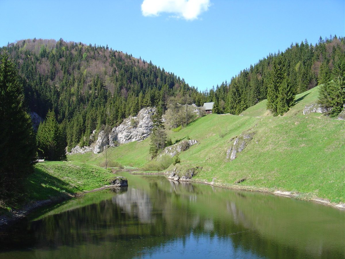
Photo: CC BY-SA 3.0
The Slovak Paradise, Slovensky raj, is a small limestone plateau in the east of Slovakia, south of the High Tatras, cut by a dozen narrow gorges with waterfalls, and it offers a kind of walking found nowhere else in central Europe: the marked trails go straight up the beds of the gorges, and up the waterfalls themselves, by means of iron ladders, chains, wooden catwalks and metal steps bolted to the rock over the water. It is easily reached. The town of Spisska Nova Ves, on the main railway line between Bratislava and Kosice, lies at its northern edge, and the airport and rail junction of Poprad, the gateway to the Tatras, is half an hour away. There are three bases. Podlesok, near the village of Hrabusice, on the north-western side, is the most popular, with campsites, cabins and car parks, and is the starting point for the two most famous gorges; Cingov, near Spisska Nova Ves, serves the Hornad canyon and the viewpoint of Tomasovsky vyhlad;
and Dedinky, a village on a reservoir on the southern side, reached by a scenic railway, is the quietest. A small entrance fee is charged in the season, together with parking fees. The essential rules are that the gorges with ladders may be walked in the uphill direction only, to avoid people meeting on the ladders, and that one returns by a different path over the plateau. The classic day is Sucha Bela, from Podlesok, a gorge of about four kilometres with a series of waterfalls climbed by tall vertical ladders, which takes two to two and a half hours up, with a return by a forest road, some five hours in all. Piecky and Velky Sokol are longer and wilder, and the Prielom Hornadu, the breach of the Hornad river, sixteen kilometres, is followed not up a stream but along the canyon wall on chains and steel footplates above the river. The plateau's other sight is the Dobsinska ice cave, on the southern side, with guided tours.
Live prices from GetYourGuide for tours whose route includes this park. Free cancellation on most of them.
The area was made a protected landscape in 1964, the first in Slovakia, and a national park in 1988, the date of 2016 sometimes quoted referring to a revision of its zones, and it covers about 198 square kilometres. The name Slovak Paradise was coined in 1921 by members of a local tourist club, and it caught on. The plateau is a block of pale Triassic limestone and dolomite, lying between eight hundred and eleven hundred metres, flat and forested on top, where the water sinks into sinkholes and caves, and bounded on the north by the river Hornad, which has cut through it a winding canyon sixteen kilometres long and up to three hundred metres deep. Short, steep streams, draining from the edges of the plateau to the Hornad and to the Hnilec on the south, have sawn back into it a series of extraordinarily narrow ravines, in places barely a metre or two wide at the bottom, with vertical walls, choked with fallen trunks and boulders, down which they fall in cascades, the highest being the Zavojovy waterfall in the Sokolia dolina, some sixty-five metres. Until the twentieth century these gorges were impassable, and they were first forced by local mountaineers and tourists only between about 1900 and the 1930s, the fitting of the ladders and footplates, which makes them accessible to any reasonably agile walker, following from the 1950s. There are now some three hundred kilometres of marked trails.
The cold, damp, shaded depths of the gorges create an inverted climate, in which mountain plants grow at the bottom and warmth-loving ones on the sunny rims above, and the park has a flora of some nine hundred species, with many Carpathian endemics and more than thirty kinds of orchid; forests of beech, fir and spruce, with relict pines on the crags, cover nine tenths of it, and shelter brown bears, wolves, lynx, wildcats, otters, red deer, chamois, which were introduced, golden eagles, the black stork, the wallcreeper and, along the streams, the dipper, together with more than two thousand species of butterflies and moths. Underground, the plateau is riddled with caves, more than four hundred of them. The Dobsinska ice cave, discovered in 1870, is among the largest ice caves in Europe and lies at the unusually low altitude of 970 metres: it contains more than a hundred thousand cubic metres of ice, up to twenty-six metres thick, in frozen waterfalls, pillars and a great level floor, on which public skating was held until the 1940s, and in 1887 it became one of the first caves in the world to be lit by electricity; since 2000 it has been a World Heritage Site, as part of the caves of the Slovak and Aggtelek karst. On the meadow of Klastorisko, in the middle of the plateau, where a mountain hut now stands, lie the excavated ruins of a Carthusian monastery, founded in 1305 on the rock where the people of the Spis region had taken refuge from the Mongol invasion of 1241, and abandoned in the sixteenth century.
The gorges are open to walkers from about mid-June to the end of October, being closed in winter and spring because of ice on the ladders, high water and the nesting season, though a few are opened to guided ice climbers and walkers in midwinter, when the frozen waterfalls are spectacular; the rest of the park, the Hornad canyon and the plateau are accessible all year. July and August are the warmest months, 20 to 25 degrees, and much the busiest, with queues at the ladders in Sucha Bela from mid-morning, so that a start at seven is advisable; June, when the water is highest, and September and October, when the beeches turn, are better.
After heavy rain the gorges can flood dangerously and are closed. The ladders and footplates are wet and slippery, there is no way of avoiding the water, and a head for heights is required, so wear waterproof boots with a good grip, bring gloves, and do not take small children or dogs into the ladder gorges. The ice cave is open from mid-May to the end of September, closed on Mondays, and is cold, around freezing. Allow two to three days. The medieval towns of Levoca and Spis castle, both World Heritage Sites, are half an hour away, and the High Tatras forty minutes.
57 km away
Pieniny is a very small park in the far south of Poland, on the Slovak border two hours from Kraków and an hour east of…
5 tickets & tours
156 km away
The Hortobagy is the great treeless plain of eastern Hungary, the puszta of song and legend, and its national park lies…
1 ticket or tour
Yes. GetYourGuide sells tickets and guided tours whose route includes Slovak Paradise National Park; live prices are shown on this page.
A small entrance fee is charged in the season, together with parking fees.
The ice cave is open from mid-May to the end of September, closed on Mondays, and is cold, around freezing.
Allow two to three days.
Slovak Paradise National Park covers 198 km².
Slovak Paradise National Park was established in 1988.
Slovak Paradise National Park is in Slovakia. The map on this page shows the exact spot.
Slovakia
The Low Tatras are the second highest mountains of Slovakia, a single long ridge running east and west for some eighty…
No online ticket
Slovakia
The Slovak Tatra National Park, known by its initials as TANAP, covers the southern and larger side of the Tatra…
No online ticket