Chitwan National Park
Nepal
Chitwan is Nepal's answer to an African safari, a lowland jungle park in the Terai five or six hours by road from…
77 tickets & tours
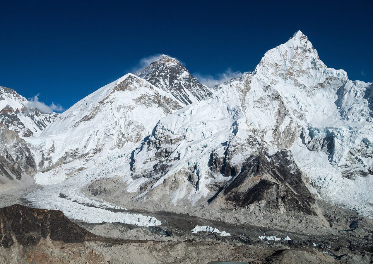
Photo: Vyacheslav Argenberg, CC BY 4.0
Sagarmatha National Park, in the Khumbu region of north-eastern Nepal, contains Mount Everest and several others of the highest mountains on earth, and the walk to the foot of Everest through the villages of the Sherpa people is the most famous trek in the world. There are no roads: everything and everybody moves on foot, or on the backs of porters, yaks and mules, or by helicopter. Nearly all trekkers begin with a flight of thirty-five minutes in a small aircraft to the airstrip of Lukla, at 2,840 metres, a short, sloping runway ending in a mountainside, which has an alarming reputation; in the busy seasons these flights leave not from Kathmandu but from the airfield of Manthali, four to five hours' drive from the capital, in the early morning, and they are cancelled for whole days at a time by cloud and wind, so that spare days must be allowed at the end of a trip. The alternative is to walk in from the roadhead at Salleri or Jiri, which adds four to seven days and helps with acclimatisation.
From Lukla the trail follows the gorge of the Dudh Kosi to the park entrance at Monjo, where permits are checked, and climbs steeply to Namche Bazaar, the Sherpa capital, a horseshoe of lodges, bakeries and gear shops at 3,440 metres, where everyone spends two nights. The standard trek continues by the monastery of Tengboche, Dingboche, Lobuche and Gorak Shep to Everest base camp, at 5,364 metres, and to the viewpoint of Kala Patthar, 5,545 metres, from which, as not from base camp, the summit is seen, and takes twelve to fourteen days there and back from Lukla. The alternatives are the turquoise lakes of Gokyo and the viewpoint above them, less crowded and scenically finer, and the demanding circuit of the three high passes. Lodges with beds, meals and, increasingly, hot showers and internet line every route, so that no camping equipment is needed. Since 2023 Nepalese rules have required foreign trekkers to take a licensed guide, though the practice in the Khumbu has been variable; a park entry fee and a local municipality fee are paid on the way.
Live dates and prices from GetYourGuide. Free cancellation on most tickets.
The national park was established on 19 July 1976 and inscribed as a World Heritage Site in 1979, and covers 1,148 square kilometres of the upper catchment of the Dudh Kosi, the milk river, all of it above 2,845 metres and more than two thirds of it barren rock, snow and ice above five thousand. Sagarmatha, a Sanskrit name coined in the twentieth century and variously translated as the forehead of the sky or the goddess of the sky, is the Nepali name for the mountain that the Sherpas and Tibetans call Chomolungma, the goddess mother of the world, and that the British surveyors of India, who calculated in 1852 that it was the highest on earth, named in 1865 after a former surveyor general, Sir George Everest, who objected. Its height is now agreed by Nepal and China to be 8,848.86 metres. With it stand Lhotse, 8,516 metres, the fourth highest, Cho Oyu, 8,188, the sixth, the great wall of Nuptse, Pumori, and Ama Dablam, 6,812 metres, the most beautiful of them all, a fang of ice with outstretched ridges that dominates the trail for days; the Khumbu, Ngozumpa and other glaciers, all shrinking and spawning unstable lakes, fill the upper valleys. Below the ice, the valleys carry forests of blue pine, silver fir, birch, juniper and rhododendron, which flowers in April and May, and shelter the Himalayan tahr, the musk deer, the red panda, the snow leopard, which has returned after an absence of decades, the Himalayan monal, Nepal's national bird, the blood pheasant and the lammergeier.
The Sherpas, whose name means people of the east, are Tibetan Buddhists who crossed the Nangpa La from Tibet some five hundred years ago and lived by growing barley and potatoes, herding yaks and trading salt and wool across the passes, until the closure of the Tibetan border in 1959. About seven thousand of them live in the park, which they regard as a beyul, a sacred hidden valley, where the killing of animals is forbidden, and the landscape is marked by their faith, by prayer flags, long walls of stones carved with mantras, which are passed on the left, whitewashed chortens, water-driven prayer wheels, and monasteries, of which Tengboche, rebuilt after an earthquake in 1934 and a fire in 1989, on a wooded spur facing Everest and Ama Dablam, is the most famous, the scene each autumn of the masked dances of Mani Rimdu. Foreigners were first admitted to the Khumbu in 1950, and on 29 May 1953 Edmund Hillary, a New Zealand beekeeper, and the Sherpa Tenzing Norgay reached the summit of Everest. Hillary devoted the rest of his life to the Sherpas, building the airstrip at Lukla, some thirty schools, hospitals at Kunde and Phaplu, bridges and water supplies, and urging the creation of the park. More than fifty thousand trekkers now come each year, and several hundred climbers attempt the mountain each spring, with the attendant problems of rubbish, sewage, deforestation for firewood, which has been banned within the park, and queues on the summit ridge.
There are two trekking seasons. The autumn, from late September to the end of November, after the monsoon has washed the air clean, offers the clearest skies, stable weather and the finest views, and is the busiest time, October above all, when lodges on the main trail fill up; nights at the higher lodges fall to minus ten degrees and lower. The spring, from March to May, is warmer, with the rhododendrons in flower lower down and the expedition tents at base camp, but with more haze and afternoon cloud.
In winter, from December to February, the skies are often brilliantly clear and the trails empty, but it is bitterly cold and the high passes may be blocked by snow; the monsoon, from June to mid-September, brings rain, cloud, leeches below and frequent cancellation of flights. Acute mountain sickness is the chief danger and kills trekkers every year: ascend no more than three to five hundred metres a day above three thousand metres, take the rest days, drink plenty, and descend at once if symptoms become severe. Insurance covering helicopter evacuation is essential. Allow sixteen to eighteen days from Kathmandu.
Yes. GetYourGuide lists 121 tickets and tours for Sagarmatha National Park, with live dates and prices and free cancellation on most of them.
Since 2023 Nepalese rules have required foreign trekkers to take a licensed guide, though the practice in the Khumbu has been variable; a park entry fee and a local municipality fee are paid on the way.
Allow sixteen to eighteen days from Kathmandu.
Sagarmatha National Park covers 1 148 km².
Sagarmatha National Park was established in 1976.
Sagarmatha National Park is in Nepal. The map on this page shows the exact spot.
Nepal
Chitwan is Nepal's answer to an African safari, a lowland jungle park in the Terai five or six hours by road from…
77 tickets & tours
Nepal
Langtang is the Himalayan park closest to Kathmandu, a day's drive north to the trailhead at Syabrubesi, and it is…
55 tickets & tours
Nepal
Shivapuri is the forested ridge that closes the Kathmandu valley on the north, its gate at Budhanilkantha forty minutes…
17 tickets & tours
Nepal
Bardiya is the great wilderness of Nepal's far-western lowlands, and what Chitwan was forty years ago: as large,…
3 tickets & tours