Kemeri National Park
105 km away
Ķemeri is the bog and forest park behind the Baltic resort of Jūrmala, forty-five minutes west of Riga, and its single…
8 tickets & tours

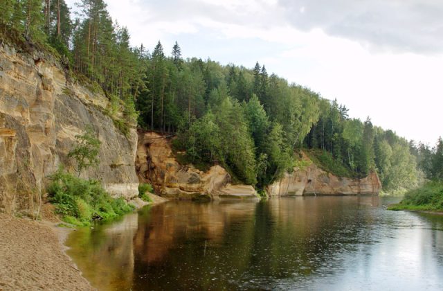
Photo: Dace Kundrāte, CC BY-SA 4.0
Slitere lies at the northern tip of Courland, the western peninsula of Latvia, where the open Baltic meets the gulf of Riga at Cape Kolka, and it combines old, wet forest, a long, empty shore of white sand, and the fishing villages of the Livonians, one of the smallest peoples of Europe. It is about 160 kilometres, two and a half hours by road, from Riga, by way of the pleasant hill town of Talsi, and buses from Riga run a few times a day to Kolka and along the coast, though a car or a bicycle gives much more freedom; the port of Ventspils is an hour to the south-west. There are no gates and no entrance fee, only small charges for the lighthouse and for parking at the cape. The park falls into three parts.
The first is the Blue Hills, an ancient sea cliff, thirty to fifty metres high, which runs parallel to the present coast several kilometres inland, clothed in broadleaved forest: on its edge stands the Slitere lighthouse, a red brick tower of 1850, now a small museum and viewing tower, from whose top, on a clear day, one sees across the forest to the sea and the Estonian island of Saaremaa, and at its foot begins the Slitere nature trail, a circuit of about a kilometre and a half by wooden steps and boardwalk down the cliff, through a forest of great age and luxuriance, and round the springs and fens at its base, which can be walked only with a park guide, booked in advance. The second is the coast: Cape Kolka, where the two seas collide in a line of breaking waves over a sandbank that stretches out for kilometres, with a visitor centre, a pine trail and a bird-watching tower; and, strung along the shore road to the west, the villages of Vaide, Kosrags, Pitrags, Saunags and Mazirbe, with a nature trail of three and a half kilometres over dunes and bog at Pedzes. The third, the great inland bogs, is strictly closed.
Live prices from GetYourGuide for tours whose route includes this park. Free cancellation on most of them.
Slitere is the oldest protected area in the Baltic states, a reserve having been declared on the forested cliff in 1921, soon after Latvia's independence, and enlarged into a strict state nature reserve in the Soviet period; the national park was created in 2000 and covers about 265 square kilometres, of which a hundred are sea. It is often described as an open-air museum of the history of the Baltic, because its landforms record, more clearly than anywhere else, the stages by which the sea took shape after the ice age. The Blue Hills are the shoreline of the Baltic ice lake, which stood here some ten thousand years ago; as the land, relieved of the weight of the ice, slowly rose, the sea withdrew northwards in stages, leaving behind a level plain ridged with a series of some hundred and fifty parallel dunes, called kangari, up to two or three kilometres long, separated by narrow, waterlogged hollows, called vigas, which have filled with peat, a corrugated landscape, unique in Europe in its extent, that can be grasped only from the air. Because the area was protected so early, and because, under Soviet rule, the whole coast was a closed military border zone, from which the inhabitants were largely removed and into which nobody could travel without a permit, its forests were left alone for the greater part of a century. Those on and under the old cliff, fed by springs, are of a rich, humid, broadleaved type, with ash, elm, lime, oak, yew and ivy, more typical of western Europe, and shelter hundreds of species of mosses and lichens, the rare lady's slipper orchid and the Baltic ivy;
the dunes carry old, dry pine forest, and the hollows alder swamps and fens. Almost every large animal of the Baltic forest lives here, elk, red and roe deer, wild boar, wolves, lynx, beavers and otters, together with the black stork, the capercaillie, the eagle owl and the white-backed woodpecker. Cape Kolka is one of the great bird migration points of northern Europe: the peninsula funnels the birds that follow the coast of the Baltic, and in April and May, and again in autumn, tens of thousands of songbirds, pigeons, geese, cranes and birds of prey may pass over the cape in a single day. The cape has always been feared by sailors, the shoal off it having wrecked countless ships, and an artificial island with a lighthouse stands six kilometres out to sea. The Livonians, or Livs, a Finnic people related to the Estonians, who gave their name to medieval Livonia, were reduced over the centuries to a dozen fishing villages on this shore, the Livonian coast, and the deportations, the ban on coastal fishing and the dispersal of the Soviet years all but extinguished them; the last native speaker of their language died in 2013, though it is being taught again, and their green, white and blue flag flies at the cultural centre at Mazirbe, where they gather each August. The villages, of weathered wooden houses, net sheds, smokehouses and, in the dunes at Mazirbe, a graveyard of rotting fishing boats, are of great charm.
The park is open all year, though the lighthouse, the guided trail and the visitor centres operate mainly from May to October. For birds, the peak of the spring migration at Cape Kolka falls from about mid-April to mid-May, and that of the autumn migration in September and October. June is the month of the orchids and of the white nights; July and August are the warmest, 18 to 23 degrees, with the sea, never warm, reaching 17 to 19 degrees, the smoked fish at its best, and the Livonian festival at Mazirbe on the first Saturday of August;
even then the beaches are nearly empty. Autumn brings mushrooms, cranberries and storms, winter ice along the shore and deep quiet. Swimming at the tip of Cape Kolka itself is forbidden and dangerous, because of the currents where the seas meet, but is safe along the beaches on either side. Mosquitoes and ticks are present in the forest in summer. Bring binoculars and a windproof. Allow one to two days. Talsi and the manor of Dundaga, with its castle, are half an hour inland, Ventspils an hour away.
105 km away
Ķemeri is the bog and forest park behind the Baltic resort of Jūrmala, forty-five minutes west of Riga, and its single…
8 tickets & tours
177 km away
Zemaitija National Park lies in the hilly lake country of Samogitia, the north-western region of Lithuania, about…
2 tickets & tours
188 km away
Gauja is the oldest and largest national park in Latvia, a wooded river valley in the region of Vidzeme north-east of…
3 tickets & tours
Yes. GetYourGuide sells tickets and guided tours whose route includes Slitere National Park; live prices are shown on this page.
There are no gates and no entrance fee, only small charges for the lighthouse and for parking at the cape.
There are no gates and no entrance fee, only small charges for the lighthouse and for parking at the cape.
The park is open all year, though the lighthouse, the guided trail and the visitor centres operate mainly from May to October.
Allow one to two days.
Slitere National Park covers 265 km².
Slitere National Park was established in 2000.
Slitere National Park is in Latvia. The map on this page shows the exact spot.
Latvia
Ķemeri is the bog and forest park behind the Baltic resort of Jūrmala, forty-five minutes west of Riga, and its single…
8 tickets & tours
Latvia
Gauja is the oldest and largest national park in Latvia, a wooded river valley in the region of Vidzeme north-east of…
3 tickets & tours