Trakai Historical National Park
106 km away
Trakai is a small town on a narrow peninsula among lakes, twenty-eight kilometres west of Vilnius, the capital of…
1 ticket or tour
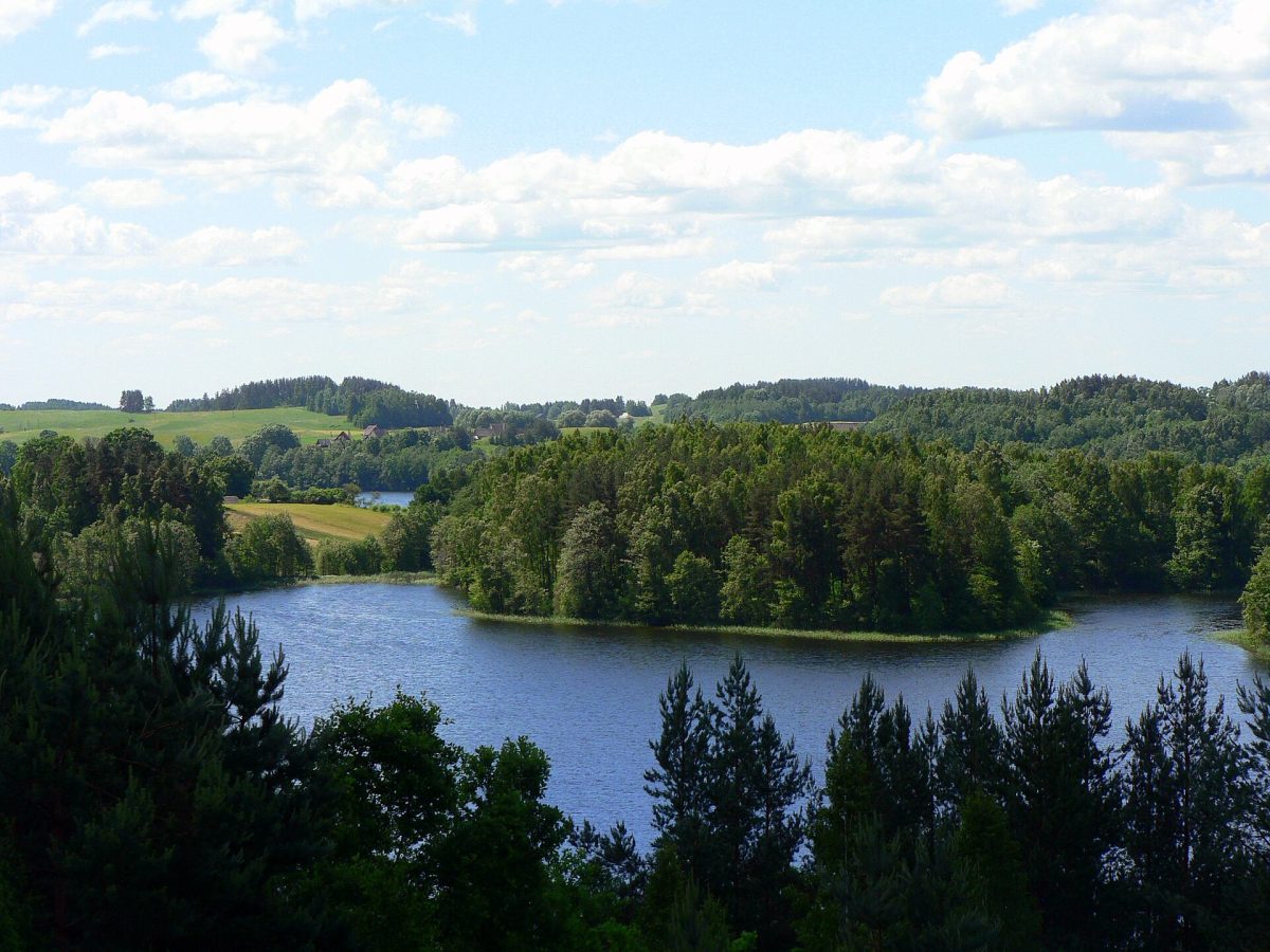
Photo: Wojsyl, CC BY-SA 3.0
Aukstaitija is the lake district of north-eastern Lithuania, about a hundred kilometres north of the capital, Vilnius, a gently rolling country of pine forest in which more than a hundred lakes lie linked by streams and channels, and it is the oldest of the country's national parks and the favourite of Lithuanians for a quiet summer holiday on and beside the water. The small town of Ignalina, just outside the park, is reached from Vilnius by train in an hour and a half to two hours, or by road in about the same time, and the park's centre, the lakeside village of Paluse, lies five kilometres beyond it, with the park's visitor centre, a boat hire station, a campsite, guesthouses and a cafe or two. There are no gates, and a modest visitor's ticket, bought online or at the centre, is asked of those using the park.
The classic way to see it is from a canoe or kayak, hired at Paluse or from several other outfitters, who also transport boats and people: because the lakes are joined, one can paddle for a few hours, or follow marked water routes of two to several days, camping at designated sites on the shores, through a chain of a dozen lakes and the little rivers between them. On land, cycling is ideal, with marked routes on forest roads and quiet lanes, and the essential places can be linked in a day by bicycle or car: the wooden church at Paluse; the hill of Ladakalnis, a short climb from a car park near Ginuciai, from which six lakes are seen at once; the hill fort of Ginuciai, reached by a long flight of wooden steps; the old watermill in the same village; the beekeeping museum at Stripeikiai; and the old villages of Suminai, Salos and Strazdai. A botanical trail starts at Paluse. Swimming is possible almost anywhere.
Live prices from GetYourGuide for tours whose route includes this park. Free cancellation on most of them.
The national park was founded in 1974, the first in Lithuania, and indeed the first in the republic's Soviet period, when it bore the name of the Lithuanian SSR; it took its present name, that of the ethnographic region of the Lithuanian highlands, in 1991, and covers about 406 square kilometres, of which some seventy per cent is forest, chiefly of Scots pine, with spruce and birch, and about fifteen per cent water. The landscape was left by the last ice sheet, which retreated from here some twelve thousand years ago, leaving ridges of moraine, mounds, and long, narrow troughs gouged by meltwater beneath the ice, in which lie the 126 lakes, many of them ribbon-shaped, deep and clear. Tauragnas, at 62.5 metres, is the deepest lake in Lithuania; Baluosas has seven islands, one of which contains a small lake of its own; and the view from Ladakalnis, a hill on which, tradition holds, sacrifices were offered to Lada, the mother goddess of the pagan Balts, takes in six lakes lying among wooded ridges to the horizon. Lithuania was the last country in Europe to accept Christianity, in 1387, and the pre-Christian past is close to the surface here: the park contains some forty-five burial mound cemeteries and a number of hill forts, conical earthworks of the ninth to twelfth centuries on which timber castles stood, part of the defences against the raids of the Livonian knights, of which those at Ginuciai, Taurapilis and Puziniskis are the most impressive.
The villages, about a hundred of them, some of only three or four farmsteads, are built entirely of wood, with log houses, barns, granaries, bathhouses and carved crosses at the roadside, and several are protected as ethnographic monuments; they lie deep in the forest, and their people lived by fishing, gathering mushrooms and berries, and beekeeping. The church of St Joseph at Paluse, built in 1750, with a separate octagonal bell tower, is said to have been put together with the axe alone, without saw or iron nails, and is regarded as the oldest surviving wooden church in the country; it appeared on the one-litas banknote. The watermill of Ginuciai, of the nineteenth century, retains its machinery. At Stripeikiai, the museum of ancient beekeeping, on a hillside among wooden sculptures of bees, gods and legends, shows how honey was taken from wild colonies in hollow pine trunks and later from hives made of sections of log, and sells honey and mead. The forests shelter elk, red and roe deer, wild boar, wolves, lynx, otters, beavers, mountain hares and pine martens, with ospreys, black storks, cranes, capercaillie, black grouse and black-throated divers among more than two hundred species of birds, and the clean lakes hold vendace, pike, perch, tench and crayfish. Forty kilometres to the east stood the Ignalina nuclear power station, with reactors of the Chernobyl type, which was closed in 2009 as a condition of Lithuania's entry into the European Union.
The park can be visited all year. The season for canoeing, swimming and camping runs from June to August, when the days are very long, the air 20 to 25 degrees and the lakes warm up to 20 to 23 degrees; July and early August are the busiest weeks, and boats and lakeside rooms should be booked ahead at weekends. Late August and September bring mushrooms, cranberries and lingonberries, which the whole country turns out to gather, the first autumn colours and empty lakes, and May and early June have fresh green, bird song and few people.
Winter, from December to March, is cold and snowy, the lakes freeze hard and are used by ice fishermen and skaters, and there are cross-country ski tracks and a small ski hill at Ignalina. Mosquitoes are troublesome in June and July, and ticks, which here can carry encephalitis and Lyme disease, are present in the forest from spring to autumn, so use repellent and check the skin. Allow two to three days. The hill of Moletai with its observatory and ethnocosmology museum is forty-five minutes away, and Vilnius under two hours.
106 km away
Trakai is a small town on a narrow peninsula among lakes, twenty-eight kilometres west of Vilnius, the capital of…
1 ticket or tour
230 km away
Gauja is the oldest and largest national park in Latvia, a wooded river valley in the region of Vidzeme north-east of…
3 tickets & tours
234 km away
Ķemeri is the bog and forest park behind the Baltic resort of Jūrmala, forty-five minutes west of Riga, and its single…
8 tickets & tours
Yes. GetYourGuide sells tickets and guided tours whose route includes Aukstaitija National Park; live prices are shown on this page.
Allow two to three days.
Aukstaitija National Park covers 406 km².
Aukstaitija National Park was established in 1974.
Aukstaitija National Park is in Lithuania. The map on this page shows the exact spot.
Lithuania
Zemaitija National Park lies in the hilly lake country of Samogitia, the north-western region of Lithuania, about…
2 tickets & tours
Lithuania
Trakai is a small town on a narrow peninsula among lakes, twenty-eight kilometres west of Vilnius, the capital of…
1 ticket or tour