Zion National Park
Utah, United States
Zion is the most visited of Utah's parks and the closest to Las Vegas, about two and a half hours away, and the…
45 tickets & tours
Canyon Park · Utah · United States

Photo: Bob Palin, CC BY-SA 2.5
Capitol Reef is the least visited and, many regular visitors think, the most rewarding of Utah's five national parks, a long, narrow strip of cliffs, domes and canyons in the south-centre of the state, on Highway 24 beside the small town of Torrey, about three and a half hours from Salt Lake City, two and a half from Moab and two from Bryce Canyon along Scenic Byway 12, one of the finest drives in America; it has nothing to do with the Capitol in Washington, whose tours appear beside it in searches. It is a park for a car, and much of it is free: Highway 24 runs through the middle, past the visitor centre, the petroglyph panel, the old Fruita schoolhouse, the Hickman Bridge trailhead and the Goosenecks and Sunset Point overlooks, without any fee.
The entrance fee, per vehicle for seven days, paid at a self-service station, applies only to the Scenic Drive, a paved road of about thirteen kilometres south from Fruita along the foot of the cliffs, with unpaved spurs into Grand Wash and Capitol Gorge, narrow canyons that can be walked between sheer walls. The day hikes are the point: Hickman Bridge, a natural arch, three kilometres return; Cassidy Arch, steeper, named for Butch Cassidy, who is said to have hidden hereabouts; Cohab Canyon, Chimney Rock, and the Grand Wash narrows. The few tours sold are 4×4 day trips from Torrey into Cathedral Valley, the remote northern district, reached by a loop of ninety-odd kilometres of rough dirt road that begins by fording the Fremont river, to the free-standing monoliths called the Temples of the Sun and the Moon; the Burr Trail and Notom road loop serves the south. Horse rides, canyoneering and fly-fishing are offered by Torrey's outfitters.
Live dates and prices from GetYourGuide. Free cancellation on most tickets.
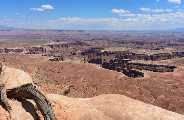
The area was proclaimed a national monument by Franklin Roosevelt in 1937, after years of promotion by two local men, Ephraim Pectol and Joseph Hickman, who called it Wayne Wonderland, and became a national park in 1971; it covers about 979 square kilometres, nearly a hundred kilometres long and on average only ten wide, because it follows a single geological feature. The Waterpocket Fold is a monocline, a great step-like wrinkle in the earth's crust some 160 kilometres long, formed between fifty and seventy million years ago when movement on a buried fault lifted the rock layers on the west side more than two thousand metres above those on the east; erosion has since exposed the tilted edge of nearly ten thousand feet of strata, nineteen formations spanning 200 million years, in a rampart of coloured cliffs, the red Moenkopi and Chinle at the base, the sheer orange Wingate walls, and on top the pale, rounded Navajo sandstone. The early settlers called any such barrier to travel a reef, and the white domes reminded them of the dome of the Capitol, hence the name;
the waterpockets are the potholes in the sandstone that hold rain. Along the Fremont river, the Fremont people, farmers and hunters contemporary with the Ancestral Puebloans, lived from about 300 to 1300 and left panels of petroglyphs, trapezoidal human figures with headdresses and necklaces, bighorn sheep and abstract signs, on the cliffs beside the road. In 1880 Mormon pioneers founded the hamlet of Fruita at the river's junction with Sulphur Creek, never more than ten families, who planted orchards irrigated by ditches; the last residents left in 1969, and the Park Service maintains the orchards, some nineteen hundred trees of cherries, apricots, peaches, pears and apples, heirloom varieties among them, in which visitors may pick and eat fruit free in season and pay by weight for what they carry away. The Gifford farmhouse sells fruit pies that are locally famous. Mule deer browse under the trees, and the park is a certified dark-sky park.
The park is open all year, at all hours, with the visitor centre from about 8 am to 4.30 pm and longer in summer. Spring, from March to May, with the orchards in blossom from late March, and autumn, from September to October, with the cottonwoods golden and apples to pick, are the best seasons; the fruit harvest runs from mid-June, with cherries, to October;
summer is hot, 32 to 38 degrees, and July to September is the season of thunderstorms and flash floods, when the slot canyons and the washes, including the Scenic Drive's spurs, must be avoided if rain threatens anywhere upstream; winter is cold, quiet and occasionally snowy, with the red rock at its most vivid. Carry water on every hike. Allow a full day, two with Cathedral Valley. Torrey is ten minutes west, Goblin Valley an hour east, and Bryce Canyon two hours south-west by Highway 12.
Yes. GetYourGuide lists 2 tickets and tours for Capitol Reef National Park, with live dates and prices and free cancellation on most of them.
The entrance fee, per vehicle for seven days, paid at a self-service station, applies only to the Scenic Drive, a paved road of about thirteen kilometres south from Fruita along the foot of the cliffs, with unpaved spurs into Grand Wash and Capitol Gorge, narrow canyons that can be walked between sheer walls.
The park is open all year, at all hours, with the visitor centre from about 8 am to 4.30 pm and longer in summer.
Allow a full day, two with Cathedral Valley.
Capitol Reef National Park covers 979 km².
Capitol Reef National Park was established in 1971.
Capitol Reef National Park receives about 1.4 million a year (2024).
Capitol Reef National Park is in Utah, United States. The map on this page shows the exact spot.
Utah, United States
Zion is the most visited of Utah's parks and the closest to Las Vegas, about two and a half hours away, and the…
45 tickets & tours
Utah, United States
Bryce Canyon, in southern Utah, is a small park with one overwhelming sight, a series of natural amphitheatres filled…
19 tickets & tours
Utah, United States
Arches is the park of red sandstone arches beside Moab in eastern Utah, and its entrance has been the most managed in…
13 tickets & tours
Utah, United States
Canyonlands is the larger, emptier neighbour of Arches, outside Moab in south-eastern Utah, and the first thing to know…
8 tickets & tours