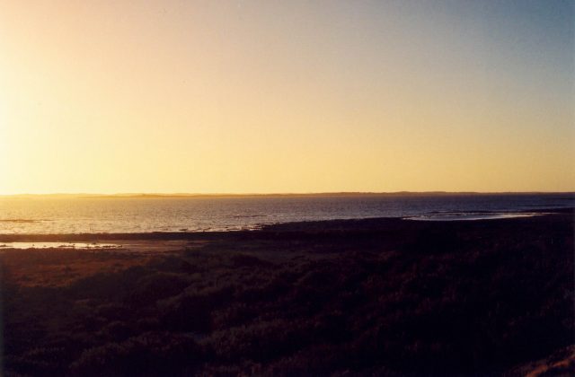
Coffin Bay National Park
South Australia, Australia
Coffin Bay National Park occupies a long, hooked peninsula on the western side of the southern Eyre Peninsula in South…
1 ticket or tour
Mountain Park · South Australia · Australia
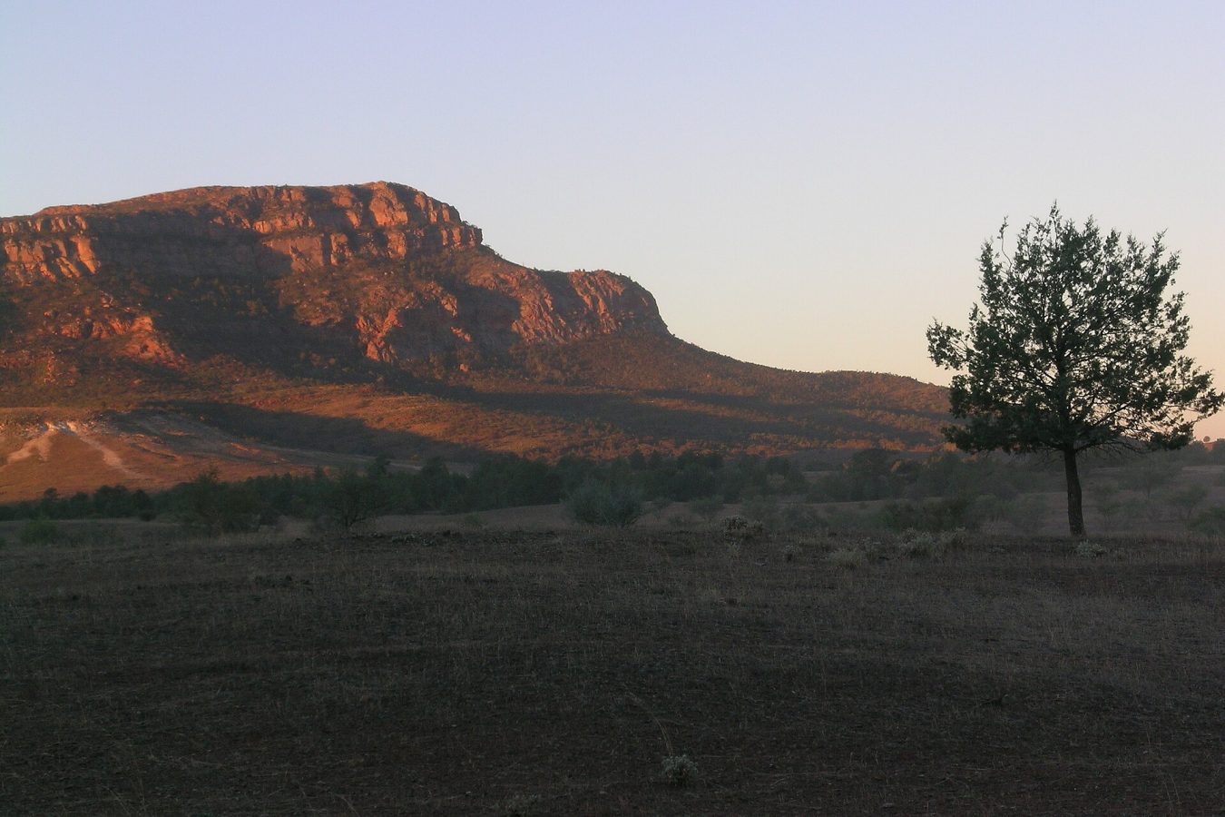
Photo: self, CC BY-SA 3.0
The Flinders Ranges are the great mountain chain of South Australia, a line of rugged, purple and ochre ridges running north from the head of Spencer Gulf into the desert, and the national park protects their central and most spectacular part, about 430 kilometres and five hours by sealed road north of Adelaide, by way of Port Augusta or the Clare valley and the little town of Hawker, the last place for supplies. There is no public transport of use, though coach and four-wheel-drive tours of several days run from Adelaide. An entry fee per vehicle is paid online. The centre of everything is Wilpena Pound, where there are a visitor centre, a resort hotel, a large campground under river red gums, a store and fuel, all owned by the Adnyamathanha traditional owners, and an airstrip from which scenic flights of twenty or thirty minutes give the only view that shows the Pound for what it is. Cars cannot enter the Pound itself.
From the resort a shuttle bus and a level walk of an hour through the only gap in the wall lead to the ruined Hills homestead and up a short, steep track to the Wangarra lookouts on the inner rim; the full day's climb towards St Mary Peak, some twenty kilometres and eight to nine hours, is the classic walk, and visitors are asked by the Adnyamathanha, for whom the summit is sacred, to stop at the Tanderra saddle, just below it, which has the same view. Elsewhere in the park, gravel roads, usually passable by ordinary cars in dry weather, lead through the Bunyeroo and Brachina gorges, the latter signposted as a geological trail, to the Aroona valley, and to short walks at Arkaroo Rock, for its ochre and charcoal paintings, and the Sacred Canyon, whose engravings are now seen only with an Aboriginal guide. Station stays, camping in the gorges and guided cultural tours are all available.
Live dates and prices from GetYourGuide. Free cancellation on most tickets.
A reserve was declared at Wilpena in 1945 and the national park was established in 1972; it covers about 950 square kilometres, and in 2016 it was renamed and placed under co-management with the Adnyamathanha, the people of the rocks, ikara meaning meeting place, which is their name for the Pound. The ranges as a whole are on Australia's tentative list for World Heritage. Wilpena Pound is a vast natural amphitheatre, seventeen kilometres long and eight wide, a shallow, oval basin of grassland and native pine completely enclosed by a saw-toothed wall of quartzite that rises to 1,171 metres at St Mary Peak, the highest point of the Flinders, and drops in cliffs on the outside. It looks like a crater and is nothing of the kind: it is the stump of a great downfold in layers of sediment that were laid down on a sea floor between about 650 and 500 million years ago, crumpled into mountains as high as the Himalaya, and then worn away, the hard quartzite surviving as the rim. In the Adnyamathanha account, the walls are the bodies of two giant serpents, the Akurra, who encircled a gathering of people come for a ceremony, ate them, and lay down, so full that they could not move, the head of one being St Mary Peak. The rocks of the park have a special place in the story of life.
In the gorges, which cut straight across the grain of the ranges, one can walk or drive through more than a hundred million years of strata, tilted on end like the pages of a book, and in the hills to the west, in 1946, the geologist Reg Sprigg found in the sandstone the impressions of soft-bodied creatures, fronds, discs and quilted mats, that lived some 550 million years ago and are the oldest complex animals known on earth; they gave their name to a new period of geological time, the Ediacaran, the first to be added to the scale in more than a century, and its official reference point, a bronze disc set in the rock, lies in the bed of Enorama creek within the park. Europeans arrived in the 1850s with sheep, and in the good seasons of the 1870s wheat farmers pushed far beyond the line that the surveyor Goyder had drawn as the limit of reliable rain; the drought that followed ruined them, and their roofless stone houses stand all over the country, the Hill family's attempt to grow wheat inside the Pound itself being ended by a flood in 1914. The painter Hans Heysen, from the 1920s, made the ranges and their great twisted river red gums famous. Rabbits, goats and foxes did immense damage, and a long programme of their control has brought back the yellow-footed rock-wallaby, a most beautifully marked animal, banded in orange, grey and white, which can be seen on the scree slopes of Brachina gorge at dusk. Red kangaroos, western greys, euros, emus and wedge-tailed eagles are everywhere.
The park is open all year, but the season is the cooler half, from April to October, when the days are sunny and mild, 16 to 25 degrees, the nights cold, often below freezing in June and July, and walking is a pleasure; after winter rain, from about August to October, the ranges are carpeted with wild flowers, among them the scarlet Sturt's desert pea, and this is the most popular time, so that accommodation should be booked well ahead, as also for the school holidays.
From November to March the heat is severe, frequently above 40 degrees, long walks are dangerous and some are closed, flies are a plague, and the park may be shut on days of extreme fire danger. Rain, rare as it is, quickly makes the gorge roads impassable, and creeks can flood in minutes. Animals are active at dawn and dusk, when driving requires great care. Carry ample water, a hat and sun protection, and register for the long walks. Allow three days. The old copper town of Blinman is an hour north of Wilpena, the hotel at Parachilna an hour and a quarter, and the Arkaroola sanctuary four hours beyond.
Yes. GetYourGuide lists 3 tickets and tours for Ikara-Flinders Ranges National Park, with live dates and prices and free cancellation on most of them.
An entry fee per vehicle is paid online.
Ikara-Flinders Ranges National Park covers 941 km².
Ikara-Flinders Ranges National Park was established in 1972.
Ikara-Flinders Ranges National Park is in South Australia, Australia. The map on this page shows the exact spot.
South Australia, Australia
Coffin Bay National Park occupies a long, hooked peninsula on the western side of the southern Eyre Peninsula in South…
1 ticket or tour
South Australia, Australia
The Coorong is a long, narrow, shallow lagoon on the coast of South Australia, running for some 130 kilometres…
No online ticket
South Australia, Australia
Flinders Chase occupies the wild western end of Kangaroo Island, the third largest island of Australia, which lies off…
No online ticket
South Australia, Australia
The Naracoorte Caves lie in the south-east of South Australia, in the wine and farming country called the Limestone…
No online ticket