Budj Bim National Park
306 km away
Budj Bim, known until 2017 as Mount Eccles, is a small park round an extinct volcano in the basalt plains of…
1 ticket or tour
Wetland Park · South Australia · Australia
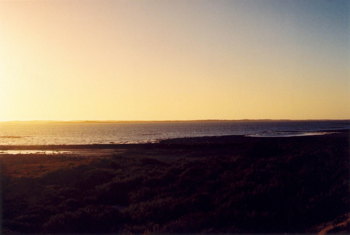
The Coorong is a long, narrow, shallow lagoon on the coast of South Australia, running for some 130 kilometres south-eastwards from the mouth of the Murray, Australia's greatest river, and separated from the Southern Ocean by a single unbroken ridge of high white sand dunes, the Younghusband peninsula, beyond which lies one of the longest and loneliest surf beaches in the country. The park begins about 150 kilometres, two hours by road, south-east of Adelaide, and the Princes Highway to Mount Gambier and Melbourne runs beside the lagoon for most of its length, so that many people see something of it in passing; the little town of Meningie, on Lake Albert at the northern end, is the usual base, and Goolwa, on the far side of the Murray mouth, is the starting point for cruises. There is no public transport of use. Entry is free, though camping must be booked and paid for online.
Those without a four-wheel drive can do a good deal from the highway: at Jack Point, a short walk leads to an observatory with telescopes trained on the islands where the pelicans breed; at Salt Creek a loop road and several marked walks, of half an hour to three hours, cross lagoon, saltpan and dune, and pass a replica of an early oil rig; at Chinamans Well an old stone well and quarry recall a forgotten migration; and the Parnka Point road leads to the narrowest part of the lagoon. To reach the ocean beach one must cross the dunes, on foot, by a walk of about a kilometre and a half at the Forty-Two Mile Crossing, or by four-wheel drive at several crossings, after which one may drive for great distances along the sand, with care for the tides and for nesting birds. The most comfortable introduction is a cruise from Goolwa, of half a day or a day, through the barrage locks to the Murray mouth and the northern lagoon, with guided walks across the dunes. Kayaking tours explore the quiet northern reaches.
Live prices from GetYourGuide for tours whose route includes this park. Free cancellation on most of them.
The national park was declared in 1966, not in 2011 as some databases state, covers about 490 square kilometres, and has been listed since 1985, with the lakes at the Murray's mouth, as a wetland of international importance under the Ramsar convention. Its name comes from karangk, a word of the Ngarrindjeri people meaning a long, narrow neck. The Ngarrindjeri have lived here for many thousands of years, in what was one of the most densely populated parts of Aboriginal Australia, thanks to the abundance of fish, waterfowl and above all cockles, and the dunes of the peninsula are lined for kilometre after kilometre with their middens, deep beds of discarded shells, with burial grounds and the sites of their semi-permanent camps; they are still the custodians of the area, take part in its management, and run a cultural centre near Meningie. The lagoon was formed over the last six or seven thousand years, as the sea, having reached its present level, built the great dune barrier across the mouth of a broad, shallow bay. It is divided into a northern lagoon, brackish, fed by the river, and a southern lagoon, which has almost no inflow and in which evaporation concentrates the salt to three or four times the strength of sea water, so that along its length the Coorong offers birds every gradation from fresh to hypersaline. More than 240 species have been recorded. The Australian pelican breeds on the islands of the southern lagoon in one of the largest permanent colonies in the country, several thousand pairs;
ducks, swans, grebes, cormorants, ibis, terns, including the threatened fairy tern, banded stilts, red-necked avocets and Cape Barren geese are present in great numbers; and each southern summer tens of thousands of small waders, sharp-tailed and curlew sandpipers, red-necked stints and others, arrive from their breeding grounds in Siberia and Alaska, ten thousand kilometres away. The place was made known to every Australian by Storm Boy, a short novel of 1964 by Colin Thiele, twice filmed here, about a boy who lives in a shack among the dunes with his father and rears an orphaned pelican called Mr Percival. It has also become a symbol of the troubles of the Murray. So much water is now taken from the river upstream for irrigation that in dry periods none reaches the sea: barrages built in 1940 across the channels cut the lagoon off from the lakes, the river mouth silted up completely in 1981 and has had to be kept open by dredges almost continuously since 2002, and during the long drought of 2006 to 2010 the southern lagoon became so salty that its aquatic plants, fish and the brine-shrimp food of the waders collapsed and the birds departed; it has only partly recovered. On the ocean beach, people still gather cockles by twisting their feet into the wet sand. In the 1850s thousands of Chinese gold seekers, landed at Robe to avoid a poll tax imposed by Victoria, walked along this shore to the diggings.
The park is open all year. The best periods are spring, from September to November, when the weather is mild, wild flowers bloom on the dunes and the migratory waders are arriving, and autumn, from March to May, which is calm and clear before they leave; the pelicans breed mainly from about July to January, and the summer months, from December to February, are warm to hot, 25 to 35 degrees, with the greatest numbers of waders, school-holiday campers and a strong sea breeze.
Winter is cool, windy and wet, with wild seas on the ocean beach, and empty. The beach south of Tea Tree Crossing is closed to vehicles from late October to late December to protect nesting hooded plovers. Driving on the beach requires lowered tyre pressures, a tide table and recovery gear, and swimming in the surf is dangerous. Bring insect repellent, water and sun protection. Allow a day or two. Goolwa and Victor Harbor are an hour and a half from Meningie round the lakes, Robe two hours south, and Adelaide two hours.
306 km away
Budj Bim, known until 2017 as Mount Eccles, is a small park round an extinct volcano in the basalt plains of…
1 ticket or tour
Yes. GetYourGuide sells tickets and guided tours whose route includes Coorong National Park; live prices are shown on this page.
Entry is free, though camping must be booked and paid for online.
The park is open all year.
Coorong National Park covers 490 km².
Coorong National Park was established in 1966.
Coorong National Park is in South Australia, Australia. The map on this page shows the exact spot.
South Australia, Australia
The Flinders Ranges are the great mountain chain of South Australia, a line of rugged, purple and ochre ridges running…
3 tickets & tours
South Australia, Australia
Coffin Bay National Park occupies a long, hooked peninsula on the western side of the southern Eyre Peninsula in South…
1 ticket or tour
South Australia, Australia
Flinders Chase occupies the wild western end of Kangaroo Island, the third largest island of Australia, which lies off…
No online ticket
South Australia, Australia
The Naracoorte Caves lie in the south-east of South Australia, in the wine and farming country called the Limestone…
No online ticket