Arrecifes de Cozumel National Park
Mexico
The reefs of Cozumel, off the Caribbean coast of the Yucatan peninsula of Mexico, are among the most celebrated diving…
75 tickets & tours
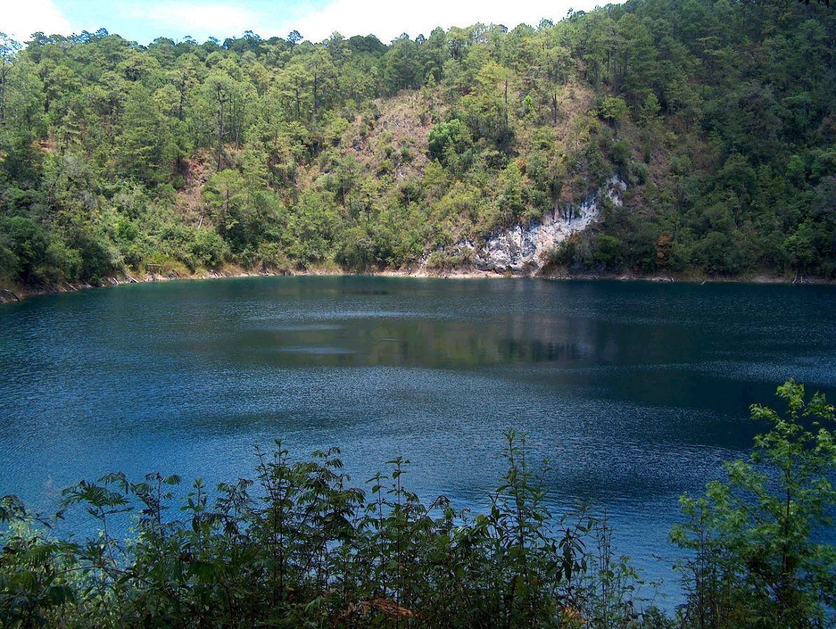
The Lagunas de Montebello are a group of more than fifty lakes scattered through pine forest on the high plateau of the Mexican state of Chiapas, right against the border with Guatemala, and they are famous for their colours, which range from pale turquoise through emerald and violet to a blue so dark that it is nearly black. The park lies about sixty kilometres, an hour by road, south-east of the colonial town of Comitan, and three hours from San Cristobal de las Casas, the usual base for travellers in highland Chiapas, from which day tours are widely sold, generally in combination with the waterfall of El Chiflon on the way; from Comitan, minibuses run frequently along the road to the park entrance and on past the lakes. A small entrance fee is paid at the national park's booth, and a second contribution is usually asked by the communal landholders, the ejidos, who own and manage much of the ground within it.
The paved road forks just inside the gate. One branch leads north to the group called the Lagunas de Colores, five lakes, Agua Tinta, Esmeralda, Ensueno, Encantada and Bosque Azul, each of a different shade, close together and linked by short paths, at the last of which there are a car park, food stalls, horses for hire, and trails to a small cave with a stream and to a natural limestone arch over a river. The other branch runs east along the border past the lakes of Montebello, Cinco Lagos, Pojoj, where rafts of lashed logs, poled by local men, carry visitors to an islet and to a cenote, Tziscao, the largest, which has a village on its shore with cabins, restaurants and kayaks, and the Lago Internacional, across which the frontier runs. Boys offer themselves as guides at every stop. Simple lodgings, camping and excellent local coffee, cheese and hot chocolate are available at Tziscao and Bosque Azul.
Live dates and prices from GetYourGuide. Free cancellation on most tickets.
The national park was created in 1959, the first in Chiapas, and covers about 64 square kilometres at an altitude of some 1,500 metres; it was declared a Ramsar wetland in 2003 and a UNESCO biosphere reserve in 2009. The lakes lie in a landscape of karst, a plateau of limestone in which rainwater has dissolved caverns and shafts, and they occupy sinkholes and collapsed caves, the cenotes of the highlands, some of them round and steep-sided and more than fifty metres deep, others broad and irregular where several hollows have merged; most have no visible inflow or outflow, being fed and drained underground, and many are connected with one another by passages beneath the forest. Their different colours are the result of differences in depth, in the minerals dissolved in the water, in the nature of the bottom and in the vegetation and the angle of the light, so that a single lake may show bands of three or four shades, and they change with the hour and the weather. Since about 2003 several lakes of the north-western group have from time to time turned a murky yellowish green, which scientists attribute to pollution, by sewage and farm chemicals, of the Rio Grande of Comitan, which flows into the system, and the matter is under study; most of the lakes remain clear.
The surrounding forest is of pines and oaks, with sweetgum, which turns red in the dry season, and in the damper hollows a cloud forest rich in orchids, of which more than fifty species grow here, and bromeliads. It suffered badly in the great fires of the spring of 1998, from which it has largely recovered. Its birds include the azure-hooded jay, the emerald toucanet, several trogons and hummingbirds, and, rarely, the resplendent quetzal, and white-tailed deer, armadillos, anteaters and ocelots are present. The district has been inhabited for a very long time. Just outside the park, at Chinkultic, a Maya city that flourished between the third and the ninth centuries stands on a series of hills and terraces, its principal temple perched on a cliff above a deep blue cenote, with a ball court, carved stelae and a wide view over the lakes; it can be visited on the way, though it has at times been closed by disputes with the local community. The people of the lakes today are largely Chuj and Tojolabal Maya, some of them the children of families who fled across the border from the Guatemalan civil war in the early 1980s and stayed. In recent years the border region of Chiapas has suffered from the violence of rival criminal groups, and travellers should check the current situation and travel by day.
The park is open daily from about 8 am to 5 pm. The dry season, from November to April, is the best time: the skies are clearer, the colours of the lakes at their most brilliant in the sunshine of late morning and midday, and the tracks dry; December to February are cool by day and cold at night at this altitude, down to five degrees, and the forest is often wrapped in mist in the early morning. The rainy season, from May to October, brings heavy showers in the afternoons, muddy paths and duller colours under cloud, though the forest is lush and orchids are in flower.
Mexican holidays, above all Easter week and the weeks round Christmas, fill the car parks and the rafts. Swimming is permitted in some lakes, the water being cold, and life jackets are required on the rafts. Bring a warm layer, a waterproof, cash in small notes and your passport, since there are immigration checkpoints on the border road. Allow a day from Comitan or San Cristobal. El Chiflon waterfall is an hour and a half from the lakes, and Comitan's colonial centre an hour.
Yes. GetYourGuide lists one ticket or tour for Lagunas de Montebello National Park, with live dates and prices and free cancellation on most of them.
A small entrance fee is paid at the national park's booth, and a second contribution is usually asked by the communal landholders, the ejidos, who own and manage much of the ground within it.
The park is open daily from about 8 am to 5 pm.
Allow a day from Comitan or San Cristobal.
Lagunas de Montebello National Park covers 64.3 km².
Lagunas de Montebello National Park was established in 1959.
Lagunas de Montebello National Park is in Mexico. The map on this page shows the exact spot.
Mexico
The reefs of Cozumel, off the Caribbean coast of the Yucatan peninsula of Mexico, are among the most celebrated diving…
75 tickets & tours
Mexico
Puerto Morelos is the fishing village between Cancún and Playa del Carmen whose reef, part of the Mesoamerican barrier…
45 tickets & tours
Mexico
Ría Lagartos is the flamingo lagoon on the northern tip of Yucatán, two hours from Valladolid and three from Cancún or…
28 tickets & tours
Mexico
Los Arcos are the granite islets with the arches off Mismaloya, twelve kilometres south of Puerto Vallarta, and the…
16 tickets & tours
Mexico
Cabo Pulmo is a village of a few hundred people on the East Cape of Baja California Sur, on the Gulf of California,…
8 tickets & tours
Mexico
Iztaccihuatl and Popocatepetl, the second and third highest mountains of Mexico, stand side by side on the eastern rim…
6 tickets & tours


