Los Glaciares National Park
Argentina
Los Glaciares is the park of the Perito Moreno glacier and the Fitz Roy massif in Argentine Patagonia, and it is…
52 tickets & tours
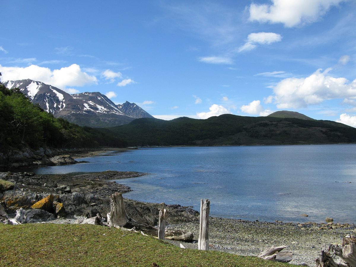
Photo: Butterfly voyages Serge Ouachée, CC BY-SA 3.0
The park is twelve kilometres west of Ushuaia and is the standard half-day excursion for everyone passing through the city, cruise passengers included, so the choice is between a bus tour, a private tour, a hike and doing it on your own. The half-day bus tours from Ushuaia drive the park road to Lapataia Bay, where the Pan-American Highway ends, with stops at Roca lake, the Ensenada Bay post office and the viewpoints, and many add the End of the World Train, the tourist steam railway that follows the old convict line into the park; the train is charming for children and a slow ride for everyone else. Private tours with a guide let you walk the Coastal Path rather than photograph it from the bus.
The guided hiking tours follow the Senda Costera from Ensenada to Lapataia, about eight kilometres of shoreline forest, and the canoeing versions paddle the Lapataia river channels to the bay, which is the most enjoyable way to end the day. Winter tours in snowshoes and the ice-climbing days on the glaciers behind Ushuaia are seasonal extras. The park entrance fee is charged per person at the gate and is usually not included in tour prices; independent visitors take the shuttle buses from the Ushuaia bus terminal or a taxi and walk. The king penguin tours sold from Punta Arenas are the Chilean side of the island, a separate trip.
Live dates and prices from GetYourGuide. Free cancellation on most tickets.
The park was created in 1960 as Argentina's first coastal national park and covers 630 square kilometres of the southern tip of the island of Tierra del Fuego, from the Beagle Channel north along the Chilean border to Lake Fagnano, though only the southern few kilometres are open to visitors. It is subantarctic forest of lenga, ñire and coihue beech, mossy and hung with old man's beard, running down to shingle bays, peat bogs and mountain lakes, with the snow peaks of the Cordillera Darwin across the water. The Coastal Path from Ensenada Bay to Lapataia Bay is the classic walk, passing beaches with shell middens left by the Yámana people and views across the channel to Chile;
Lapataia Bay itself, a fjord of glassy water, is the end of Ruta 3 and the sign marking the end of the Pan-American Highway is the photograph everyone takes. Roca lake, shared with Chile, has a trail along its shore, and the short Castorera trail passes the dams of the beavers introduced from Canada in the 1940s that have since devastated the forests. Guanacos, Andean foxes and the Magellanic woodpecker, a big red-crested bird, are the animals to look for, and upland geese and steamer ducks work the shoreline. The park is a place of long light, cold clear air and silence rather than drama.
The park is open all year from about 8 am to dusk, and the train runs daily except in the worst of winter. The southern summer from December to March has long days and temperatures around 10 to 15 degrees, with wind and sudden rain in any month; autumn in April turns the beech forest red and gold and is the most beautiful season, and winter from June to September brings snow, short days and snowshoe walks.
Cruise-ship days flood the park road in summer, so walk the Coastal Path in the morning before the coaches arrive at Lapataia. Allow half a day, or a full day with the coastal hike and canoeing. Beagle Channel boat trips to the sea-lion islands and the Les Éclaireurs lighthouse are the other essential Ushuaia excursion, and the Martial glacier is a walk from town.
Yes. GetYourGuide lists 36 tickets and tours for Tierra del Fuego National Park, with live dates and prices and free cancellation on most of them.
The park entrance fee is charged per person at the gate and is usually not included in tour prices; independent visitors take the shuttle buses from the Ushuaia bus terminal or a taxi and walk.
The park was created in 1960 as Argentina's first coastal national park and covers 630 square kilometres of the southern tip of the island of Tierra del Fuego, from the Beagle Channel north along the Chilean border to Lake Fagnano, though only the southern few kilometres are open to visitors.
Allow half a day, or a full day with the coastal hike and canoeing.
Tierra del Fuego National Park covers 630 km².
Tierra del Fuego National Park was established in 1960.
Tierra del Fuego National Park is in Argentina. The map on this page shows the exact spot.
Argentina
Los Glaciares is the park of the Perito Moreno glacier and the Fitz Roy massif in Argentine Patagonia, and it is…
52 tickets & tours
Argentina
Iguazú National Park is the Argentine side of the falls, twenty minutes from Puerto Iguazú, and it is entered with a…
11 tickets & tours
Argentina
Nahuel Huapi is the lake-and-mountain park of northern Patagonia, and the city of San Carlos de Bariloche, two hours by…
5 tickets & tours
Argentina
Villavicencio is a private nature reserve in the dry foothills of the Andes, its entrance about forty-five kilometres,…
4 tickets & tours
Argentina
Ansenuza is one of the newest national parks of Argentina and protects Mar Chiquita, an immense salt lake in the…
1 ticket or tour
Argentina
Los Cardones is a high desert park in the province of Salta, in the north-west of Argentina, and nearly everyone sees…
1 ticket or tour