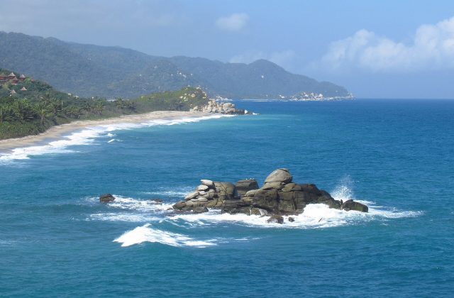
Rosario and San Bernardo Corals National Park
Colombia
The Corales del Rosario y San Bernardo is a marine park off the Caribbean coast of Colombia, protecting the coral reefs…
97 tickets & tours

Photo: nicolasgalindo, CC BY 2.0
Chicaque is a privately owned cloud-forest reserve on the south-western rim of the high plateau on which Bogotá stands, in the municipality of San Antonio del Tequendama, only about thirty kilometres from the city centre, though leaving Bogotá through the suburb of Soacha commonly takes an hour to an hour and a half, and on Sundays more. It is one of the most accessible pieces of real forest near the Colombian capital, and much used by its families, schools and birdwatchers. An entrance fee is paid at the gate at the top, on the edge of the plateau at about 2,700 metres, and from there everything is downhill: a steep, stone-paved and stepped path drops through the forest for some three kilometres, about an hour, to the refuge at about 2,100 metres, where there are a restaurant, rooms, cabins, tree houses built in the branches of great oaks, and a camping ground, and from which a network of some twenty kilometres of marked trails, graded by difficulty, radiates to a waterfall, to viewpoints on rock pinnacles and through different kinds of forest. The climb back to the gate is the hard part of the day, and the reserve runs a 4×4 shuttle and hires horses for those who prefer not to make it on foot. The day tours from Bogotá provide the transport, which is the awkward element, a guide and lunch, and the birdwatching tours, starting before dawn, are led by specialist guides who know the feeding flocks; zip lines and a canopy circuit are an optional extra. Staying the night in a tree house, in the mist, is a treat for children.
Live dates and prices from GetYourGuide. Free cancellation on most tickets.
The reserve covers about 300 hectares on the steep outer slope of the Eastern Cordillera of the Andes, where the cold, flat savanna of Bogotá ends abruptly in an escarpment and the land falls away towards the warm valley of the Magdalena river; it has been protected by the family that owns it since 1990, on land where cattle once grazed among the stumps, and it is a registered civil-society nature reserve under Colombian law. The warm, moist air that rises from the lowlands each day condenses against the slope, so that the forest stands in cloud for a good part of most days, often from late morning, which is the origin of the mist that gives the walks their atmosphere and hides their views. It is a classic Andean cloud forest, of the kind that once clothed the whole rim of the plateau and survives now only in fragments: tall trees loaded with mosses, ferns, bromeliads and orchids, tree ferns, climbing bamboo, wax palms, and the ecological heart of the reserve, a stand of the Colombian oak, Quercus humboldtii, the only oak native to South America, a species that reached the Andes from the north after the isthmus of Panama formed and that has been heavily felled elsewhere.
Seven types of forest are distinguished along the trails. The Pico del Águila, a rock spire with a lookout, gives, in a clear moment, a view down over the coffee country of Tequendama, and the waterfall trail leads to a fall of some seventy metres. More than three hundred species of birds have been recorded, which makes it one of the prime birding sites within reach of the capital: toucanets, quetzals, the Andean guan, tanagers in mixed flocks, a score of hummingbirds at the feeders by the restaurant, and the black inca, a hummingbird found only in Colombia. Sloths, kinkajous, night monkeys, armadillos, coatis and oncillas live in the forest and are seldom seen. The Muisca, the people of the plateau, held the place sacred, and the name is of their language. The Tequendama falls, a celebrated and now sadly polluted cascade of the Bogotá river, are a short drive away.
The reserve is open daily from about 8 am to 4 pm for day visitors, who must start the climb back in good time. The drier months, from December to March and in July and August, give the best chance of clear views and firm paths; in the two rainy seasons, April to May and October to November, the stone steps are slippery, mud is everywhere and the forest is at its most luxuriant and atmospheric.
Whatever the month, come early, since the mornings are clearest and the cloud usually closes in by midday, and avoid Sundays and holidays if possible. Temperatures range from about 10 to 18 degrees; wear boots with grip and bring a waterproof. Allow a full day. The Tequendama falls and their museum are fifteen minutes away, the town of La Mesa and the warm country an hour below, and Bogotá an hour and a half.
Yes. GetYourGuide lists 3 tickets and tours for Chicaque Natural Park, with live dates and prices and free cancellation on most of them.
The reserve is open daily from about 8 am to 4 pm for day visitors, who must start the climb back in good time.
Chicaque Natural Park covers 2.9 km².
Chicaque Natural Park is in Colombia. The map on this page shows the exact spot.
Colombia
The Corales del Rosario y San Bernardo is a marine park off the Caribbean coast of Colombia, protecting the coral reefs…
97 tickets & tours
Colombia
Tayrona is the park of jungle-backed beaches east of Santa Marta on Colombia's Caribbean coast, an hour from the…
19 tickets & tours
Colombia
Chicamocha National Park, universally known by its acronym Panachi, is not a national park in the conservation sense at…
4 tickets & tours
Colombia
Chingaza is the high páramo in the eastern Andes just behind Bogotá, only about fifty kilometres from the city by way…
4 tickets & tours
Colombia
Los Nevados is the high volcanic crest of the Cordillera Central of Colombia, rising directly above the coffee region,…
2 tickets & tours
Colombia
Los Katios lies in the far north-western corner of Colombia, against the border of Panama, on the left bank of the…
No online ticket