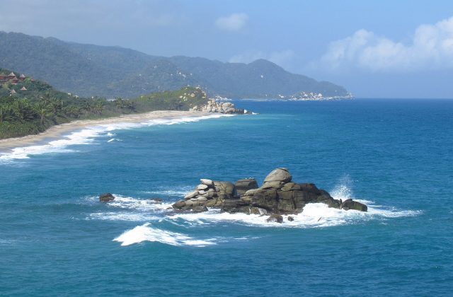
Rosario and San Bernardo Corals National Park
Colombia
The Corales del Rosario y San Bernardo is a marine park off the Caribbean coast of Colombia, protecting the coral reefs…
97 tickets & tours
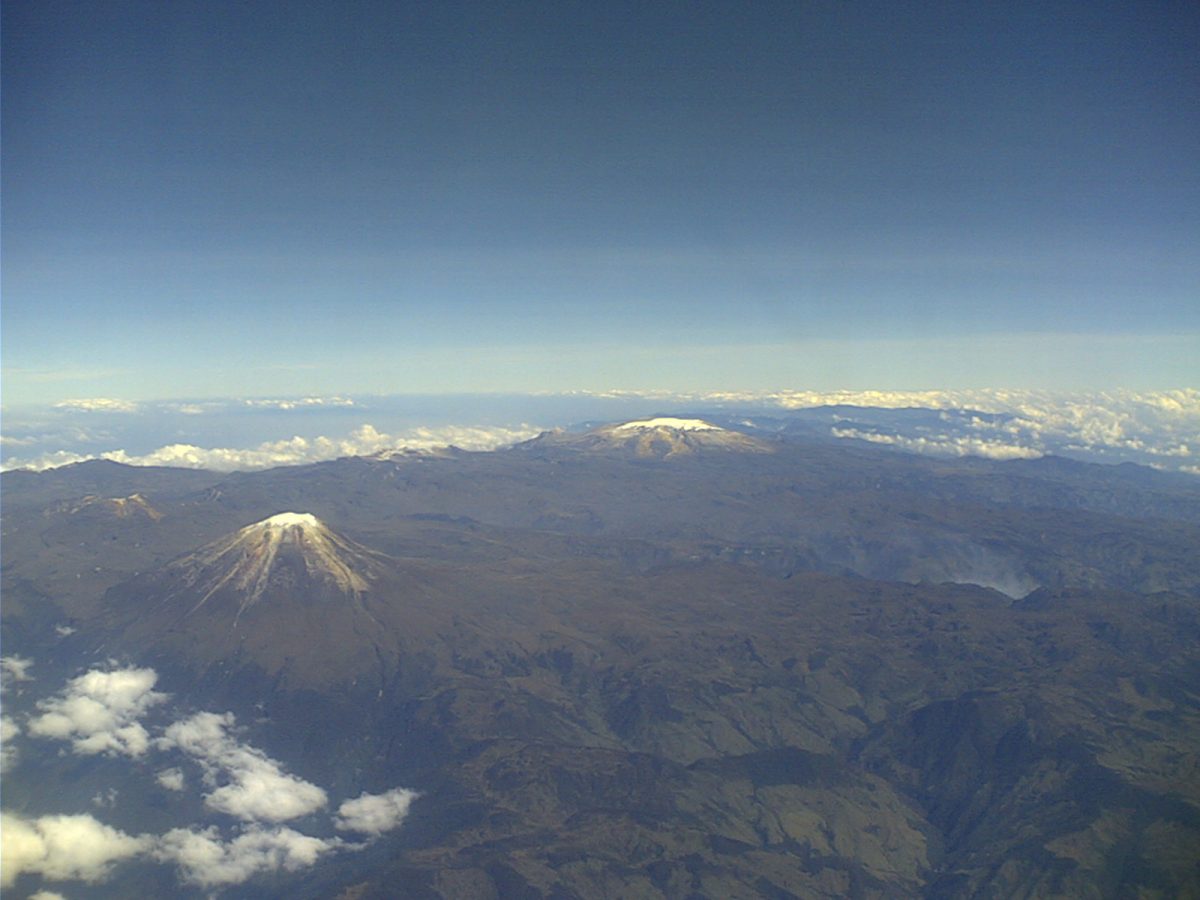
Photo: No machine-readable author provided. Mauricioagudelo~commons, CC BY-SA 3.0
Los Nevados is the high volcanic crest of the Cordillera Central of Colombia, rising directly above the coffee region, and it can be entered from three cities, Manizales, Pereira and Salento or Ibague, which give three quite different experiences. The northern sector, reached from Manizales by the road to Bogota and a turning at La Esperanza, is the only one accessible by vehicle, and is visited on day tours that leave the city at five or six in the morning by four-wheel drive or minibus: they climb through the paramo to the Brisas control post, at 4,138 metres, where the park fee is paid and an induction given, and then, as far as the volcano allows, to the Valle de las Tumbas, a lunar valley of ash at about 4,350 metres. For many years the road went on to the refuge and the snow of Nevado del Ruiz at 4,800 metres, but the volcano has been restless since 2010, and the geological service keeps it at yellow or, as in the spring of 2023, orange alert, when the whole sector is closed;
one must check before going. The tours usually end in the hot springs near Manizales, and those for birdwatchers stop on the way for the hummingbirds and the endemic parrot of the paramo. The central sector is the trekker's: Nevado de Santa Isabel, 4,965 metres, whose small glacier can be reached in a very long day from Manizales or Pereira by way of Potosi or the Conejeras route, with a compulsory guide, and the Laguna del Otun, a large lake at 3,950 metres, two days' walk from Pereira by El Cedral or from Potosi. The southern sector, entered from the Cocora valley at Salento, leads in three to five days by the Estrella de Agua and the farm of La Primavera to the Paramillo del Quindio and Nevado del Tolima, a serious glacier climb.
Live dates and prices from GetYourGuide. Free cancellation on most tickets.
The park was created in 1973 and covers 614 square kilometres, shared between the departments of Caldas, Risaralda, Quindio and Tolima, between 2,600 and 5,321 metres. It contains the northernmost active volcanoes of the Andes: Nevado del Ruiz, 5,321 metres, broad and flat-topped, with the Arenas crater steaming on its summit; Nevado del Tolima, 5,215 metres, a classic symmetrical cone; Nevado de Santa Isabel; and the paramillos of Cisne, Santa Rosa and Quindio, peaks that have lost all their ice within living memory. Ruiz is one of the deadliest volcanoes in history. On the night of 13 November 1985, after a year of warning signs, a relatively small eruption melted part of the summit ice, and mudflows, lahars, rushed down the river valleys at sixty kilometres an hour; two and a half hours later one of them, forty metres deep in the gorge above, spread across the sleeping town of Armero, seventy-four kilometres from the crater, killing some twenty-three thousand of its twenty-nine thousand people. A hazard map had been published a month earlier and no evacuation had been ordered, and the disaster, with the image of the girl Omayra Sanchez trapped for three days in the debris, transformed the monitoring of volcanoes throughout the world.
The glaciers are vanishing: Colombia's ice has shrunk by more than ninety per cent since the nineteenth century, Santa Isabel's, the lowest, was reduced by 2024 to a few fragments and is expected to disappear within years, and those of Ruiz and Tolima within decades. Below the ice and the bare ash of the superparamo lies the paramo, the high, wet, tussock moorland peculiar to the northern Andes, dominated by frailejones, Espeletia, plants of the daisy family with a thick trunk clothed in dead leaves and a rosette of felted silver leaves, which grow a centimetre a year, collect the mist and release it slowly into the peat, so that the paramo acts as a vast sponge, the source of thirty-seven rivers that supply water to some two million people and to the coffee farms below. Its animals include the spectacled bear, the mountain tapir, the puma, the pudu, the Andean condor, which was reintroduced, the buffy helmetcrest, a hummingbird found only on these volcanoes, and the rufous-fronted parakeet. Below it, cloud forest with the Quindio wax palm, the tallest palm on earth and Colombia's national tree, runs down to the Cocora valley.
The park is open daily, with entry at Brisas only from about 8 am to early afternoon, and sectors closed without notice when volcanic activity rises. The driest periods are December to March and July to August, which give the best chance of clear mornings and views of the summits; April to May and October to November are the rainiest, with cloud, sleet and mud.
At any time the mornings are clearest, cloud builds from midday, and temperatures at 4,000 metres hover near freezing with a bitter wind, so bring warm layers, gloves, a waterproof and sunscreen. The ascent from Manizales to over 4,000 metres in three hours is abrupt: spend a night or two at altitude beforehand, eat lightly and move slowly. Allow a day, three to five for a trek. Manizales is an hour and a half from Brisas, the hot springs of Santa Rosa de Cabal near Pereira, and Salento and the Cocora valley the southern gateway.
Yes. GetYourGuide lists 2 tickets and tours for Los Nevados National Natural Park, with live dates and prices and free cancellation on most of them.
The park is open daily, with entry at Brisas only from about 8 am to early afternoon, and sectors closed without notice when volcanic activity rises.
Allow a day, three to five for a trek.
Los Nevados National Natural Park covers 614 km².
Los Nevados National Natural Park was established in 1973.
Los Nevados National Natural Park receives about 39 904 a year (2016).
Los Nevados National Natural Park is in Colombia. The map on this page shows the exact spot.
Colombia
The Corales del Rosario y San Bernardo is a marine park off the Caribbean coast of Colombia, protecting the coral reefs…
97 tickets & tours
Colombia
Tayrona is the park of jungle-backed beaches east of Santa Marta on Colombia's Caribbean coast, an hour from the…
19 tickets & tours
Colombia
Chicamocha National Park, universally known by its acronym Panachi, is not a national park in the conservation sense at…
4 tickets & tours
Colombia
Chingaza is the high páramo in the eastern Andes just behind Bogotá, only about fifty kilometres from the city by way…
4 tickets & tours
Colombia
Chicaque is a privately owned cloud-forest reserve on the south-western rim of the high plateau on which Bogotá stands,…
3 tickets & tours
Colombia
Los Katios lies in the far north-western corner of Colombia, against the border of Panama, on the left bank of the…
No online ticket