Queen Elizabeth National Park
Uganda
Queen Elizabeth is Uganda's most visited savanna park, six to seven hours by road from Kampala or Entebbe, and it…
37 tickets & tours
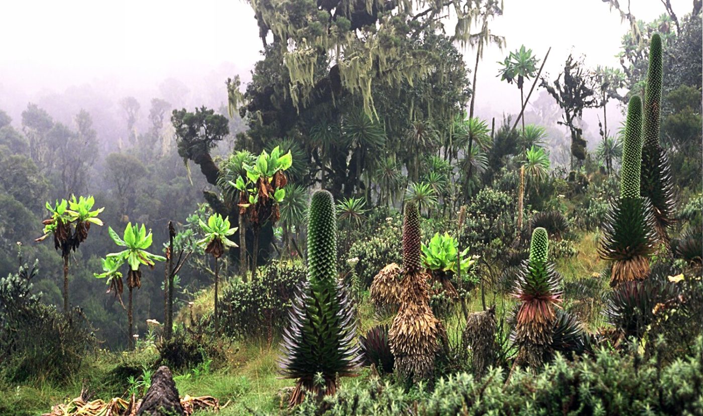
Photo: Manuel Werner, Germany(Wikipedia-Kontakt: de:Benutzer:Werner, CC BY-SA 2.5
The Rwenzori are the snow-capped Mountains of the Moon on Uganda's border with Congo, above the town of Kasese, six to seven hours by road from Kampala and an hour and a half from Fort Portal, and they are a trekker's and mountaineer's range, harder and far emptier than Kilimanjaro or Mount Kenya. All trekking is run by two concessionaires, and the choice between them is the choice of route. Rwenzori Trekking Services operates the Kilembe trail from the old copper-mining town of Kilembe above Kasese, up the southern valleys, with its own well-kept huts, and sells everything from one-day forest walks to the eight-day ascent of Margherita Peak.
Rwenzori Mountaineering Services, the community association of the Bakonzo, operates the older Central Circuit from Nyakalengija, a six- to seven-day loop up the Bujuku valley and down the Mubuku, with a side trip to the summits, and the newer Bukurungu trail in the north. Packages include park fees, guides, porters, a cook, food and hut fees, and agencies in Kampala and Fort Portal add the transport. Margherita, 5,109 metres, involves glacier travel with crampons, ice axe and rope, which the operators supply and teach, and a night at 4,500 metres; Mount Speke and Mount Baker are alternative summits, and the four- and six-day treks to the high lakes and waterfalls without a summit are fine journeys in themselves. Rubber boots are the footwear for the famous bogs, and every trekker should hire porters. The lower-slope day hikes and the Bakonzo village walks at Ruboni give a taste without the altitude.
Live dates and prices from GetYourGuide. Free cancellation on most tickets.
The park was gazetted in 1991 and listed as a World Heritage Site in 1994, covering 996 square kilometres of the Ugandan side of a range 120 kilometres long that adjoins Congo's Virunga park. Unlike the other great mountains of East Africa the Rwenzori are not volcanoes but a block of ancient crystalline rock thrust up between two arms of the rift valley, with six massifs rising above 4,500 metres and carrying, until recently, permanent ice on the equator: Mount Stanley, whose Margherita Peak at 5,109 metres is the third highest point in Africa, Speke, Baker, Emin, Gessi and Luigi di Savoia, the last named for the Duke of the Abruzzi, whose expedition of 1906 first climbed the main summits and whose photographer Vittorio Sella made them famous. Ptolemy placed the source of the Nile in snow mountains he called the Mountains of the Moon, and Henry Stanley, in 1888, was the first European to recognise them through their almost permanent cloud.
It rains here on most days of the year, over 2,500 millimetres annually, and the result is the strangest vegetation in Africa, arranged in belts: montane forest with elephants, chimpanzees and the Rwenzori turaco; bamboo; then, from 3,000 metres, the heather zone, where tree heathers ten metres tall are draped in old man's beard above cushions of coloured moss; and the Afro-alpine zone of giant lobelias, giant groundsels and everlasting flowers around black lakes and the notorious Bigo bogs, now crossed partly on boardwalks. The Rwenzori three-horned chameleon, the Rwenzori red duiker and nineteen bird species endemic to the Albertine Rift live here. The glaciers, which covered 6.5 square kilometres in 1906, have shrunk to less than one, and are expected to vanish within a decade or two. Rebel militia closed the range from 1997 to 2001.
Treks start daily by arrangement. The drier seasons, from late December to February and from June to mid-August, are the times to go, with the best chance of clear mornings, views of the peaks and firm snow; even then it rains, the nights at the high huts are below freezing, and the bogs are bogs. In the wet seasons, March to May and September to November, the trails are rivers of mud and the summits are rarely seen.
Acclimatisation matters: the longer itineraries have much higher summit success. Allow eight days for Margherita, four for the lakes. Kasese and Fort Portal are the bases, Queen Elizabeth National Park lies at the foot of the range, Kibale's chimpanzees are an hour from Fort Portal, and Semuliki's hot springs are on the far side.
Yes. GetYourGuide lists 8 tickets and tours for Rwenzori Mountains National Park, with live dates and prices and free cancellation on most of them.
Allow eight days for Margherita, four for the lakes.
Rwenzori Mountains National Park covers 996 km².
Rwenzori Mountains National Park was established in 1991.
Rwenzori Mountains National Park is in Uganda. The map on this page shows the exact spot.
Uganda
Queen Elizabeth is Uganda's most visited savanna park, six to seven hours by road from Kampala or Entebbe, and it…
37 tickets & tours
Uganda
Murchison Falls is Uganda's largest park and the one closest to Kampala for a proper savanna safari, about five…
35 tickets & tours
Uganda
Lake Mburo is the small savanna park on the Kampala–Mbarara road, about four hours from the capital, and its position…
31 tickets & tours
Uganda
Kibale is the chimpanzee forest of western Uganda, five hours from Kampala or Entebbe and forty minutes from Fort…
15 tickets & tours
Uganda
Bwindi holds about half of the world's mountain gorillas, in the far south-west of Uganda, eight to ten hours by…
8 tickets & tours
Uganda
Mgahinga is Uganda's smallest national park, in the extreme south-western corner of the country above the town of…
5 tickets & tours