Thingvellir National Park
Iceland
Thingvellir lies forty-five kilometres, about three quarters of an hour by a good road, north-east of Reykjavik, and it…
176 tickets & tours

Photo: Justraveling.com, CC BY-SA 4.0
Vatnajökull National Park covers the largest ice cap in Europe and a vast tract around it, some fourteen per cent of Iceland, and visitors meet it in separate pieces that are hours apart. The south side, along the ring road between Skaftafell and Höfn, four to five and a half hours from Reykjavík, is where the tours are. Glacier hikes on the outlet tongues, Falljökull and Svínafellsjökull from Skaftafell, Breiðamerkurjökull from the Jökulsárlón area, last three to five hours with crampons, helmet, harness and ice axe provided and a certified guide, run all year, and have age limits of eight to ten or more; ice climbing is an add-on. The natural blue ice caves, which form anew each autumn at the glacier's edge and are entered from November to March, by super-jeep from Jökulsárlón, are the winter's prize, and they should only ever be visited with a reputable operator, a point underlined by the fatal collapse of an ice feature on a summer tour in 2024.
Kayaking among the icebergs of the Heinabergslón and Fjallsárlón lagoons, and the amphibious and zodiac boats on Jökulsárlón, which is just outside the park proper, run in summer, as do snowmobile and super-jeep trips onto the ice cap from the Jöklasel hut. The two- and three-day south-coast tours from Reykjavík bundle these with the waterfalls and Vík. The northern part, Jökulsárgljúfur, with Dettifoss and Ásbyrgi, belongs to the Diamond Circle tours from Akureyri and Mývatn. The highland sections, Askja, Laki, Eldgjá and Snæfell, need a 4×4 and open only in summer. The park is free, with parking fees at Skaftafell and Jökulsárlón.
Live dates and prices from GetYourGuide. Free cancellation on most tickets.
The park was founded in 2008 by merging the older national parks of Skaftafell, from 1967, and Jökulsárgljúfur, from 1973, with the ice cap and much more; it was extended in 2019 to about 14,700 square kilometres and inscribed that year as a World Heritage Site under the title Dynamic Nature of Fire and Ice. The Vatnajökull ice cap itself covers some 7,700 square kilometres, with ice up to 950 metres thick, and buries several central volcanoes, among the most active in Iceland: Grímsvötn, which erupted in 2011, Bárðarbunga, whose fissure eruption at Holuhraun in 2014 and 2015 produced the largest lava field in Iceland since the Laki eruption of 1783, and Öræfajökull, whose rim carries Hvannadalshnúkur, 2,110 metres, the country's highest peak. Eruptions under the ice melt it into lakes that burst out as jökulhlaups, glacial floods, which built the black outwash plains of the south coast, swept away the ring-road bridges on Skeiðarársandur in 1996, and are the interplay of volcano and glacier for which the park was listed.
Some thirty outlet glaciers descend from the cap, almost all of them retreating fast, which is how the lagoon of Jökulsárlón, where icebergs calved from Breiðamerkurjökull drift out to sea past seals and wash up on a black beach, has come to exist within the last ninety years and is now the deepest lake in the country. At Skaftafell, the park's main visitor centre and campsite, trails lead to Svartifoss, a waterfall over a cliff of hexagonal basalt columns, and to viewpoints over the ice. In the north, the glacial river Jökulsá á Fjöllum has cut a canyon twenty-five kilometres long, into which Dettifoss, the most powerful waterfall in Europe, drops forty-five metres, and Ásbyrgi is a horseshoe canyon of birchwood, the hoofprint of Odin's horse. Reindeer graze the eastern highlands, and arctic foxes and pink-footed geese the interior.
The lowland areas are accessible all year, weather and road closures permitting; the highland roads open from about late June to September. Summer, June to August, has the midnight light, all activities except the ice caves, and the most visitors; the natural ice caves run from about November to March, when daylight is four to seven hours, storms close the ring road without warning and the northern lights compensate;
glacier hikes run all year. Check the road and weather services every morning in winter, and do not walk on a glacier or under ice without a guide. Allow two days for the south side from Reykjavík, more for the north. Höfn is the eastern base, Kirkjubæjarklaustur the western, Vík and the south-coast waterfalls are on the way, and Mývatn is an hour from Dettifoss.
Yes. GetYourGuide lists 8 tickets and tours for Vatnajökull National Park, with live dates and prices and free cancellation on most of them.
The lowland areas are accessible all year, weather and road closures permitting; the highland roads open from about late June to September.
Allow two days for the south side from Reykjavík, more for the north.
Check the road and weather services every morning in winter, and do not walk on a glacier or under ice without a guide.
Vatnajökull National Park covers 14 703 km².
Vatnajökull National Park was established in 2008.
Vatnajökull National Park is in Iceland. The map on this page shows the exact spot.
Iceland
Thingvellir lies forty-five kilometres, about three quarters of an hour by a good road, north-east of Reykjavik, and it…
176 tickets & tours
Iceland
Skaftafell is the visitor hub on the south side of the Vatnajökull ice cap, four hours east of Reykjavík on the ring…
19 tickets & tours
Iceland
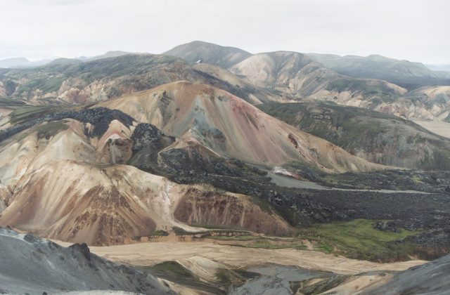
Fjallabak is a reserve in the uninhabited southern highlands of Iceland, a wilderness of multicoloured rhyolite…
8 tickets & tours
Iceland
Snaefellsjokull National Park occupies the tip of the Snaefellsnes peninsula, a finger of land ninety kilometres long…
2 tickets & tours