Teide National Park
8 km away
Teide is the volcano at the centre of Tenerife and the most visited national park in Spain, and it is reached from…
48 tickets & tours
Forest Park · Canary Islands · Spain
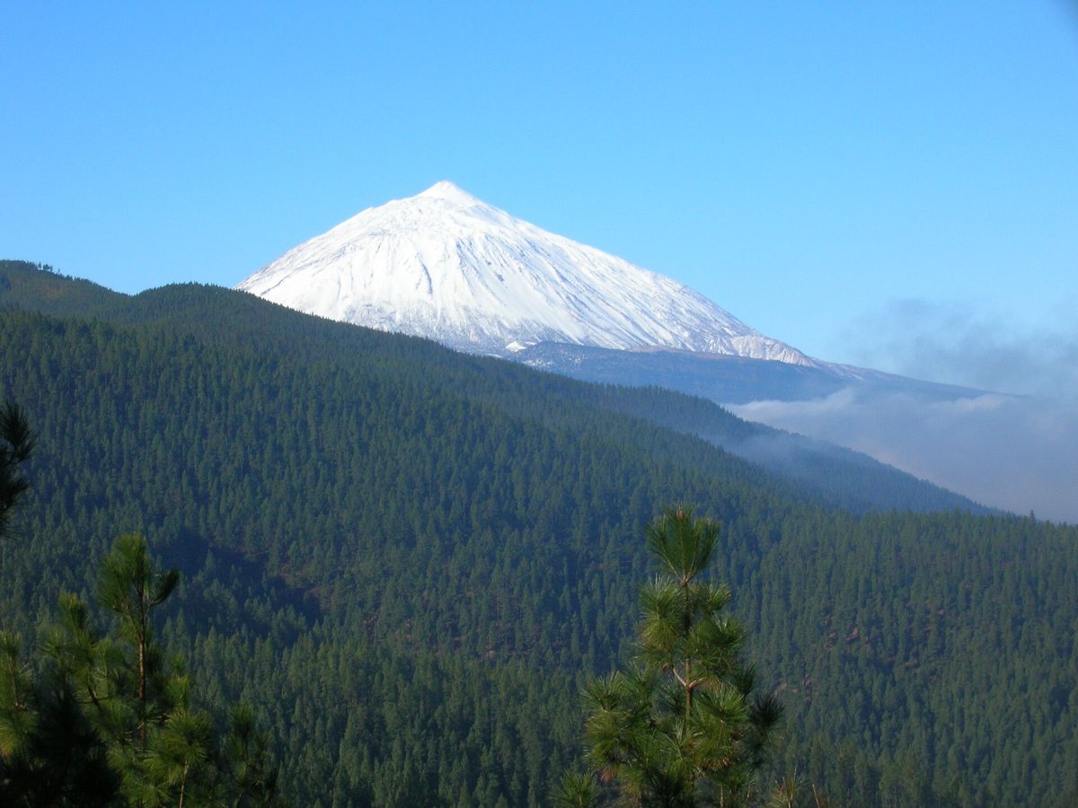
Photo: barraquito, CC BY-SA 2.0
The Corona Forestal, the forest crown, is the great ring of pine woods that encircles the high central part of Tenerife, in the Canary Islands, surrounding the Teide national park on every side, and it is the largest protected area of the archipelago. Almost every visitor to Tenerife passes through it, since all four roads that climb to Teide from the coasts, from La Orotava in the north, La Laguna along the spine of the island, Vilaflor in the south and Chio in the west, run through it for many kilometres, rising from the zone of cultivation, entering the pines at about a thousand metres and leaving them at about two thousand, where the bare volcanic desert begins; but few stop. It is free, open, and without gates or centres of its own, and its facilities consist of viewpoints beside the roads, a dozen large recreation areas among the trees, equipped with tables, water, toilets and stone barbecues, which the islanders fill on Sundays, and a network of marked trails.
A hired car is the practical way of reaching them, the buses up to Teide being few. The ridge road from La Laguna, by La Esperanza, offers a succession of viewpoints from which Teide is seen above a sea of cloud. The best-known walk is to the Paisaje Lunar, the lunar landscape, above Vilaflor, the highest village of the island: a group of pale cones and pinnacles of eroded volcanic ash in the middle of the pine forest, reached by a circular trail of about thirteen kilometres and four to five hours from the village, or more briefly from a forest track. In the north, from the recreation area of La Caldera, above La Orotava, a splendid circuit of about thirteen kilometres follows a ledge under the cliffs called the Organ Pipes, and in the west a marked loop of six kilometres crosses the black lava round the Chinyero volcano.
Live prices from GetYourGuide for tours whose route includes this park. Free cancellation on most of them.
The natural park was declared in 1987 and reclassified in 1994, and covers about 46,600 hectares, nearly a quarter of the island, between roughly 300 and 2,700 metres, taking in the headwaters of most of Tenerife's ravines and several of its historical volcanoes. It is, above all, the realm of the Canary pine, a tree found wild only in these islands, tall, straight and long-needled, with its needles in bundles of three, which forms here the largest and best forests that survive. It is one of the most fire-resistant trees in the world: its thick, layered bark protects the living tissue, and after a fire that leaves nothing but blackened poles, the trunks and branches put out tufts of new blue-green needles within months, so that a burnt forest is green again in a few years. This ability has been tested repeatedly, by great fires in 2007 and 2012 and above all in August 2023, when the largest wildfire on the island for forty years burned some fourteen thousand hectares of the northern and eastern forest, and visitors will see both the scars and the recovery. The heartwood of old trees, called tea, dense, resinous and almost imperishable, was the timber of the balconies, ceilings and church roofs of the historic towns of the islands, and the forests were heavily exploited for it, for pitch and for charcoal until the twentieth century, much of the present woodland being the result of replanting from the 1940s onwards.
A few giants remain, notably the Pino Gordo near Vilaflor, more than forty-five metres tall and some nine metres round, which is thought to be seven or eight hundred years old. The forest's most important function is invisible. The north-east trade winds push a layer of cloud against the northern slopes between about 800 and 1,500 metres, the celebrated sea of clouds, and the long needles of the pines comb moisture from the passing fog, which drips to the ground and multiplies several times the water received from rain alone, recharging the aquifer from which, through hundreds of horizontal galleries bored into the mountain, the island draws almost all its water. Beneath the pines the undergrowth is sparse, of rock rose, broom and tree heath. The forest is the home of the Tenerife blue chaffinch, a large, slate-blue finch found nowhere else in the world, which feeds on pine seeds and comes to drink at the taps of the recreation areas, above all at Las Lajas above Vilaflor, where birdwatchers wait for it, and of local races of the great spotted woodpecker, the goldcrest, the kestrel and the sparrowhawk, together with the Tenerife lizard. The Chinyero volcano was the scene of the last eruption on Tenerife, which lasted ten days in November 1909, and the Garachico eruption of 1706, which destroyed the island's chief port, also broke out within the present park. At Las Raices, in the woods above La Esperanza, an obelisk marks the place where General Franco met his officers in June 1936, a month before the rising that began the civil war.
The park can be visited all year, the climate being mild at every season, though considerably cooler than on the coasts, with 10 to 20 degrees by day according to height. Winter and spring, from December to May, are the greenest and freshest time, with occasional snow and ice on the upper roads after storms, when access towards Teide may be closed for a day or two; the northern slopes are frequently in cloud, while the southern and western ones are usually in sun.
Summer, from July to September, is hot and very dry, and in periods of extreme fire danger or of the dusty east wind from the Sahara the authorities close the trails, recreation areas and sometimes the roads, and the lighting of barbecues is forbidden. Sunset and sunrise above the sea of clouds, from the viewpoints of the ridge road, are memorable. Carry water, sun protection and a warm layer, and keep to the marked paths. Allow a day. Teide National Park adjoins it, La Orotava is half an hour below La Caldera, and Vilaflor forty minutes from the southern resorts.
8 km away
Teide is the volcano at the centre of Tenerife and the most visited national park in Spain, and it is reached from…
48 tickets & tours
70 km away
Garajonay occupies the summit plateau of La Gomera, the small, round, deeply ravined island that lies within sight of…
1 ticket or tour
143 km away
The Caldera de Taburiente is an enormous, pine-clad crater-like depression that occupies the centre of the northern…
1 ticket or tour
Yes. GetYourGuide sells tickets and guided tours whose route includes Corona Forestal Natural Park; live prices are shown on this page.
Corona Forestal Natural Park covers 466 km².
Corona Forestal Natural Park was established in 1987.
Corona Forestal Natural Park is in Canary Islands, Spain. The map on this page shows the exact spot.
Canary Islands, Spain
Teide is the volcano at the centre of Tenerife and the most visited national park in Spain, and it is reached from…
48 tickets & tours
Canary Islands, Spain
Timanfaya is the lava field of south-western Lanzarote, half an hour from the island's resorts, and it is a park…
13 tickets & tours
Canary Islands, Spain
The Corralejo dunes lie immediately south of the resort town of Corralejo at the northern tip of Fuerteventura in the…
7 tickets & tours
Canary Islands, Spain
Jandía is the mountainous peninsula that forms the south-western tail of Fuerteventura in the Canary Islands, joined to…
4 tickets & tours
Canary Islands, Spain
The Caldera de Taburiente is an enormous, pine-clad crater-like depression that occupies the centre of the northern…
1 ticket or tour
Canary Islands, Spain
Garajonay occupies the summit plateau of La Gomera, the small, round, deeply ravined island that lies within sight of…
1 ticket or tour