Teide National Park
Canary Islands, Spain
Teide is the volcano at the centre of Tenerife and the most visited national park in Spain, and it is reached from…
48 tickets & tours
Forest Park · Canary Islands · Spain
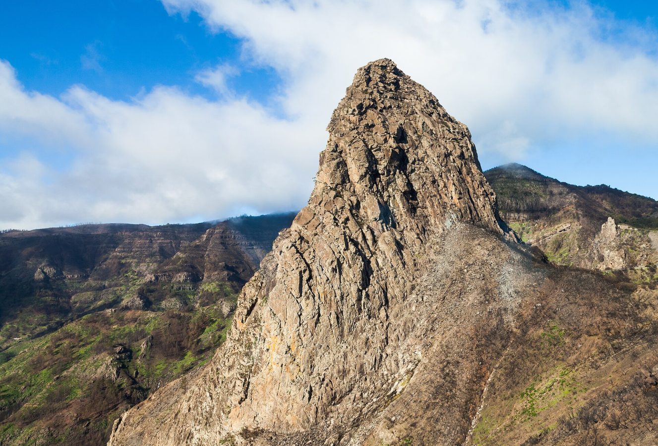
Photo: Diego Delso, CC BY-SA 3.0
Garajonay occupies the summit plateau of La Gomera, the small, round, deeply ravined island that lies within sight of the south-western coast of Tenerife, and the great majority of its visitors come for the day from there, by one of the ferries that cross in fifty minutes from the port of Los Cristianos to San Sebastian de la Gomera, either with a hired car or on an organised coach excursion, which includes the ferry ticket, a drive through the park with a short walk, a demonstration of the island's whistled language over lunch, and a return in the evening. Entry to the park is free, and no reservation is needed except for a very few restricted routes. The island's main roads all climb to the central plateau and cross the park, so that it is impossible to tour La Gomera without passing through it, and several car parks along them give access to the trails.
The principal visitor centre, Juego de Bolas, with gardens of native plants, a small ethnographic museum and craft workshops, lies outside the park boundary above the village of Agulo, in the north, which is a pity, because day visitors seldom reach it. The hub within the forest is La Laguna Grande, a circular clearing with a restaurant, a playground, picnic tables, an information point and an easy circular path of twenty minutes. The most popular walk climbs from the car park of Pajarito or of El Contadero to the Alto de Garajonay, the island's summit, in half an hour to an hour, for a view of four other islands on a clear day. The finest, from El Contadero, descends through the heart of the old forest to the hamlet of El Cedro, in about two and a half hours, along the only permanent stream, and can be continued down to Hermigua. The park's eighteen signposted trails are well maintained, and local guides lead interpretive walks.
Live dates and prices from GetYourGuide. Free cancellation on most tickets.
Garajonay was declared a national park in 1981 and a World Heritage Site in 1986, and covers 3,984 hectares, about a tenth of the island, between 650 metres and the summit at 1,487. It protects the best surviving example of the laurisilva, the evergreen laurel forest that covered much of southern Europe and north Africa in the Tertiary period, fifteen to forty million years ago, when the climate there was warm and humid, and that was extinguished on the continents by the ice ages and the drying of the Mediterranean, surviving only on the Atlantic islands of Macaronesia, the Canaries, Madeira and the Azores, where the ocean kept the climate steady. It is thus a living fossil, a forest of a vanished world. Some twenty species of trees compose it, most of them with glossy, leathery, laurel-like leaves though belonging to different families, the Canary laurel, the til, the vinatigo, the barbusano, the Canary holly, the wax myrtle and the tree heath, which here reaches fifteen or twenty metres; their trunks and branches are thickly wrapped in moss and draped with beards of lichen, ferns cover the ground, and the light is green and dim. The forest exists because of fog. The trade winds, blowing from the north-east, push moist air up the island's flank, where it condenses into a bank of cloud, the sea of clouds, that lies against the summit for much of the year;
the leaves and mosses comb the droplets from the drifting mist, so that the ground beneath the trees receives two or three times as much water as falls as rain, the phenomenon called horizontal rain, which feeds the springs on which all the island's villages and terraces depend. The park has two pigeons found only in the Canaries, the laurel pigeon and Bolle's pigeon, which feed on the fruits of the forest, together with a great number of endemic insects, snails and plants, more than a hundred and twenty of the latter being confined to the Canary Islands. On the southern edge rise Los Roques, the solidified plugs of ancient volcanoes stripped of their cones, of which Agando, beside the road, is the most imposing. The name of the park combines those of Gara, a princess of La Gomera, and Jonay, a peasant's son of Tenerife, who swam the strait on inflated goatskins to be with her: forbidden to marry and pursued to the summit, the lovers embraced with a sharpened stick of cedar set between their breasts. In August 2012 a fire, deliberately started, burned for weeks and destroyed nearly a fifth of the park; the scars on the southern side are still plain, and the old forest regenerates very slowly. The whistled language of the island, the silbo, by which shepherds spoke across the ravines, is taught in its schools and is recognised by UNESCO.
The park is open all year, and the climate varies little, mild and damp, with temperatures in the forest of 10 to 20 degrees, markedly cooler than the coast. Mist is likely in any month and most persistent in winter and spring, and should be welcomed, since the forest is at its most beautiful when wrapped in drifting cloud; the clearest views from the summit are in summer and early autumn, in the morning. Rain falls mainly from November to March.
In late summer, during spells of hot, dry wind from the Sahara, the trails may be closed because of the danger of fire. Bring a warm layer and a waterproof even if it is hot on the beach, and shoes with a good grip for the wet, rooty paths. Day visitors should take the first ferry. Allow a day, better three with walks. San Sebastian, where Columbus took on water in 1492, is forty minutes from the park, Valle Gran Rey, the main resort, forty-five, and Agulo and Hermigua on the north coast half an hour.
Yes. GetYourGuide lists one ticket or tour for Garajonay National Park, with live dates and prices and free cancellation on most of them.
Entry to the park is free, and no reservation is needed except for a very few restricted routes.
The park is open all year, and the climate varies little, mild and damp, with temperatures in the forest of 10 to 20 degrees, markedly cooler than the coast.
Allow a day, better three with walks.
Garajonay National Park covers 39.5 km².
Garajonay National Park was established in 1981.
Garajonay National Park is in Canary Islands, Spain. The map on this page shows the exact spot.
Canary Islands, Spain
Teide is the volcano at the centre of Tenerife and the most visited national park in Spain, and it is reached from…
48 tickets & tours
Canary Islands, Spain
Timanfaya is the lava field of south-western Lanzarote, half an hour from the island's resorts, and it is a park…
13 tickets & tours
Canary Islands, Spain
The Corralejo dunes lie immediately south of the resort town of Corralejo at the northern tip of Fuerteventura in the…
7 tickets & tours
Canary Islands, Spain
Jandía is the mountainous peninsula that forms the south-western tail of Fuerteventura in the Canary Islands, joined to…
4 tickets & tours
Canary Islands, Spain
The Caldera de Taburiente is an enormous, pine-clad crater-like depression that occupies the centre of the northern…
1 ticket or tour
Canary Islands, Spain
The Corona Forestal, the forest crown, is the great ring of pine woods that encircles the high central part of…
No online ticket